Tramecourt
Tramecourt | |
|---|---|
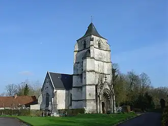 The church of Tramecourt | |
Location of Tramecourt | |
 Tramecourt  Tramecourt | |
| Coordinates: 50°27′53″N 2°09′05″E / 50.4647°N 2.1514°E / 50.4647; 2.1514 | |
| Country | France |
| Region | Hauts-de-France |
| Department | Pas-de-Calais |
| Arrondissement | Montreuil |
| Canton | Auxi-le-Château |
| Intercommunality | CC des 7 Vallées |
| Government | |
| • Mayor (2020–2026) | Gervais Castel[1] |
Area 1 | 2.22 km2 (0.86 sq mi) |
| Population (2022)[2] | 55 |
| • Density | 25/km2 (64/sq mi) |
| Time zone | UTC+01:00 (CET) |
| • Summer (DST) | UTC+02:00 (CEST) |
| INSEE/Postal code | 62828 /62310 |
| Elevation | 110–142 m (361–466 ft) (avg. 122 m or 400 ft) |
| 1 French Land Register data, which excludes lakes, ponds, glaciers > 1 km2 (0.386 sq mi or 247 acres) and river estuaries. | |
Tramecourt (French pronunciation: [tʁamkuʁ]) is a commune in the Pas-de-Calais department in the Hauts-de-France region of France[3] 16 miles (22 km) east of Montreuil-sur-Mer on the other side of the battlefield of Agincourt from the village and fortification of Azincourt, after which the battle was named.
Population
| Year | Pop. | ±% p.a. |
|---|---|---|
| 1968 | 113 | — |
| 1975 | 99 | −1.87% |
| 1982 | 76 | −3.71% |
| 1990 | 67 | −1.56% |
| 1999 | 66 | −0.17% |
| 2007 | 56 | −2.03% |
| 2012 | 59 | +1.05% |
| 2017 | 60 | +0.34% |
| Source: INSEE[4] | ||
See also
References
- ^ "Répertoire national des élus: les maires". data.gouv.fr, Plateforme ouverte des données publiques françaises (in French). 2 December 2020.
- ^ "Populations de référence 2022" (in French). The National Institute of Statistics and Economic Studies. 19 December 2024.
- ^ INSEE commune file
- ^ Population en historique depuis 1968, INSEE
Wikimedia Commons has media related to Tramecourt.
This article is issued from Wikipedia. The text is available under Creative Commons Attribution-Share Alike 4.0 unless otherwise noted. Additional terms may apply for the media files.