Trstín
Trstín | |
|---|---|
 | |
 Flag | |
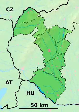 Trstín Location of Trstín in the Trnava Region  Trstín Location of Trstín in Slovakia | |
| Coordinates: 48°32′N 17°28′E / 48.53°N 17.47°E | |
| Country | |
| Region | |
| District | Trnava District |
| First mentioned | 1256 |
| Area | |
• Total | 26.19 km2 (10.11 sq mi) |
| Elevation | 236 m (774 ft) |
| Population (2021)[3] | |
• Total | 1,373 |
| Time zone | UTC+1 (CET) |
| • Summer (DST) | UTC+2 (CEST) |
| Postal code | 919 05[2] |
| Area code | +421 33[2] |
| Car plate | TT |
| Website | www |
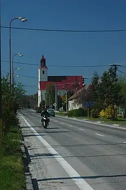
Trstín (Hungarian: Pozsonynádas) is a village and municipality of Trnava District in the Trnava region of Slovakia. Located at the foothills of Little Carpathinas it is an important road transport crossroad as two major roads I/61 and II/502 crosses here. Romanesque church from 13th century is the most worth seeing. It also has a large population of jews.[4]
External links
References
- ^ "Hustota obyvateľstva - obce [om7014rr_ukaz: Rozloha (Štvorcový meter)]". www.statistics.sk (in Slovak). Statistical Office of the Slovak Republic. 2022-03-31. Retrieved 2022-03-31.
- ^ a b c "Základná charakteristika". www.statistics.sk (in Slovak). Statistical Office of the Slovak Republic. 2015-04-17. Retrieved 2022-03-31.
- ^ "Počet obyvateľov podľa pohlavia - obce (ročne)". www.statistics.sk (in Slovak). Statistical Office of the Slovak Republic. 2022-03-31. Retrieved 2022-03-31.
- ^ "Technical Problem Form". www.jewishgen.org. Retrieved 2020-08-11.