Trzebośnica
| Trzebośnica | |
|---|---|
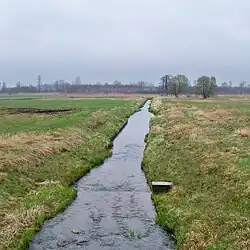 Trzebośnica on the border of Trzeboś and Kąty Trzebuskie | |
| Location | |
| Country | |
| Voivodeship | Podkarpackie |
| Physical characteristics | |
| Source | |
| • location | near Pogwizdów, Łańcut County |
| • coordinates | 50°10′21.8″N 22°06′16.1″E / 50.172722°N 22.104472°E |
| • elevation | 221.8 m (728 ft) |
| Mouth | San |
• location | northeast of Sarzyna, Leżajsk County |
• coordinates | 50°21′09″N 22°22′17″E / 50.352601°N 22.371326°E |
• elevation | 160 m (520 ft) |
| Length | 35.3 km (21.9 mi) |
| Basin size | 262.3 km2 (101.3 sq mi) |
| Basin features | |
| Progression | San→ Vistula→ Baltic Sea |
| Tributaries | |
| • right | Olechowiec |
Trzebośnica is a left tributary of the San River in southeastern Poland. Its length is 35.3 kilometres. It flows into the San near Sarzyna.