Tsater
40°57′38″N 44°37′46″E / 40.96056°N 44.62944°E
Tsater
Ծաթեր | |
|---|---|
 Tsater | |
| Coordinates: 40°57′38″N 44°37′46″E / 40.96056°N 44.62944°E | |
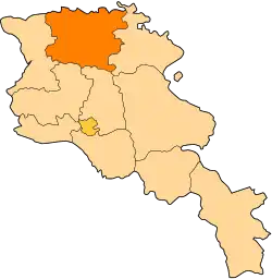
| Country | Armenia |
| Marz (Province) | Lori Province |
| Elevation | 1,200 m (3,900 ft) |
| Population (2011) | |
• Total | 377[1] |
| Time zone | UTC+4 ( ) |
| • Summer (DST) | UTC+5 ( ) |
Tsater (Armenian: Ծաթեր) is a village in the Lori Province of Armenia. There is a small S. Astvatsatsin church on the southern edge of the village with a bell tower which was used as an electrical substation in Soviet times. About 3/4 kilometer north of the village, abutting the cliff is a small Chgnavor chapel of the 11-12th century.
References
- ^ "Lori (Armenia): Towns and Villages in Municipalities". www.citypopulation.de. Retrieved 2025-04-18.
- Tsater at GEOnet Names Server
- Report of the results of the 2001 Armenian Census, Statistical Committee of Armenia