Tucalota Hills
| Tucalota Hills | |
|---|---|
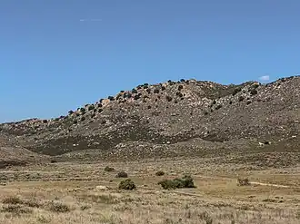 Tucalota Hills near the entrance of Lake Skinner Recreational Reserve | |
| Highest point | |
| Elevation | 2,477 ft (755 m) |
| Geography | |
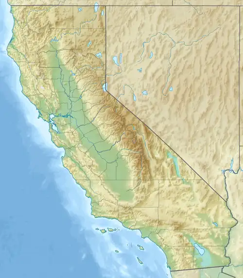 Tucalota Hills location of Tucalota Hills in California[1]  Tucalota Hills Tucalota Hills (the United States) | |
| Country | United States |
| State | California |
| Region | Peninsular Ranges |
| District | Riverside County |
| Range coordinates | 33°35′39.49″N 117°00′5.77″W / 33.5943028°N 117.0016028°W |
| Topo map | USGS Tucalota Hills |
The Tucalota Hills are a low mountain range of the Peninsular Ranges System, in Riverside County, California.[1]
Geography
They are located east of Lake Skinner reservoir, southwest of Hemet, northeast of Temecula.
Diamond Valley reservoir fills a basin in their northwestern area.
The San Jacinto Mountains are to the northeast, and Santa Ana Mountains to the west.
See also
- Mountain ranges of Riverside County, California
References
External links
 Media related to Tucalota Hills at Wikimedia Commons
- U.S. Geological Survey Geographic Names Information System: Tucalota Hills