Turakpura
Turakpura
Turakpurá | |
|---|---|
Village | |
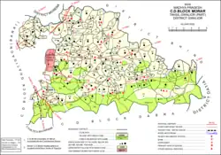 Map showing Turakpura (979) in Morar CD block | |
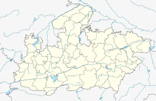 Turakpura Location in Madhya Pradesh, India  Turakpura Turakpura (India) | |
| Coordinates: 26°17′N 78°30′E / 26.283°N 78.500°E[1] | |
| Country | |
| State | Madhya Pradesh |
| District | Gwalior |
| Area | |
• Total | 1.513 km2 (0.584 sq mi) |
| Population (2011)[2] | |
• Total | 167 |
| • Density | 110/km2 (290/sq mi) |
| Languages | |
| • Official | Hindi |
| Time zone | UTC+5:30 (IST) |
Turakpura (Turakpurá)[1] is a village in Morar block of Gwalior district, in Madhya Pradesh, India.[2] As of 2011, the village population is 167, in 43 households.[2]
History
At the beginning of the 20th century, Turakpura was part of Gwalior State.[1] Located in the pargana and zila of Gird Gwalior, it had a population of 40 and an area of 680 bighas.[1]
References
- ^ a b c d Luard, C.E.; Sheopuri, Dwarka Nath (1908). Gwalior State Gazetteer Vol. I, Part III: Village List. Lucknow: Newul Kishore Press. p. 18. Retrieved 14 May 2021.
- ^ a b c d "Census of India 2011: Madhya Pradesh District Census Handbook - Gwalior, Part A (Village and Town Directory)" (PDF). Census 2011 India. pp. 196–203. Retrieved 14 May 2021.