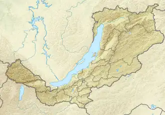
Turka (Lake Baikal)
| Turka Турка | |
|---|---|
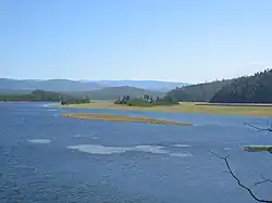 View of the river near its mouth | |
 Mouth location in Buryatia, Russia | |
| Location | |
| Country | Russia |
| Federal subject | Buryatia |
| Physical characteristics | |
| Source | |
| • location | Ikat Range |
| • coordinates | 53°15′31″N 110°40′53″E / 53.25861°N 110.68139°E |
| • elevation | 1,430 m (4,690 ft) |
| Mouth | Lake Baikal |
• coordinates | 52°56′16″N 108°12′56″E / 52.93778°N 108.21556°E |
• elevation | 456 m (1,496 ft) |
| Length | 272 km (169 mi) |
| Basin size | 5,870 km2 (2,270 sq mi) |
| Discharge | |
| • average | 49.6 m3/s (1,750 cu ft/s) |
| Basin features | |
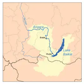
| Progression | Lake Baikal→ Angara→ Yenisey→ Kara Sea |
The Turka (Russian: Турка) is a river in the Republic of Buryatia, Russian Federation. It is one of the rivers flowing into Lake Baikal, and is 272 kilometres (169 mi) long, with a drainage basin of 5,870 square kilometres (2,270 sq mi).[1] The Turka is fast-flowing and is good for rafting.[2]
Course
The Turka begins in the Ikat Range at an elevation of 1,430 m (4,690 ft), near where this range joins with the northern end of the Ulan-Burgas. It flows roughly westwards and southwestwards through rugged mountain terrain. Finally the river joins Lake Baikal in the lake's eastern shore by Turka village.[3][4]
The main tributaries of the Turka are the Yambuy, Golonda, Ara-Khurtak, Uta, Urykta, Osinovka and Kotochik. Lake Kotokel lies 7.5 km (4.7 mi) southwest of the river mouth. The villages of Zolotoy Klyuch and Sobolikha are located by the Turka.[5]
See also
References
- ^ Russian State Water Register - Turka
- ^ The Rivers of Lake Baikal - Первый Байкальский
- ^ Geographic Encyclopedic Dictionary: Geographic Names / A.F. Treshnikov (ed.) - 2nd ed., Ext. - M . Great Soviet Encyclopedia
- ^ Turka At Sobolikha
- ^ Google Earth
External links
 Media related to Turka River at Wikimedia Commons
- Turka River kayaking