USA-260
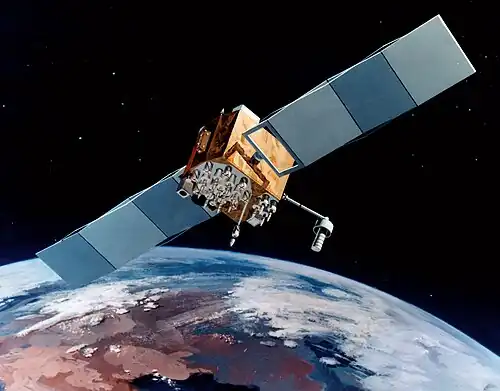 A Block IIF GPS satellite | |
| Mission type | Navigation |
|---|---|
| Operator | US Air Force |
| COSPAR ID | 2015-013A[1] |
| SATCAT no. | 40534[1] |
| Mission duration | 12 years (planned) |
| Spacecraft properties | |
| Spacecraft | GPS SVN-71 (IIF-9) |
| Spacecraft type | GPS Block IIF |
| Manufacturer | Boeing |
| Launch mass | 1,630 kilograms (3,590 lb)[2] |
| Start of mission | |
| Launch date | 25 March 2015, 18:36 UTC |
| Rocket | Delta IV-M+(4,2), D371[3] |
| Launch site | Cape Canaveral SLC-37B[3] |
| Contractor | ULA |
| Orbital parameters | |
| Reference system | Geocentric |
| Regime | Medium Earth (Semi-synchronous) |
| Perigee altitude | 20,445 km (12,704 mi)[4] |
| Apogee altitude | 20,468 km (12,718 mi)[4] |
| Inclination | 55.00 degrees[4] |
| Period | 729.14 minutes[4] |
| Epoch | 25 March 2015, 23:57:44 UTC |
USA-260, also known as GPS IIF-9, GPS SVN-71 and NAVSTAR 73, is an American Satellite navigation which forms part of the Global Positioning System. It was the ninth of twelve Block IIF satellites to be launched.[2]
Launch
Built by Boeing and launched by United Launch Alliance, USA-260 was launched at 18:36 UTC on 25 March 2015, atop a Delta IV carrier rocket, flight number D370, flying in the Medium+(4,2) configuration.[3] The launch took place from Space Launch Complex 37B at the Cape Canaveral Air Force Station,[5] and placed USA-260 directly into medium Earth orbit.[4]
Orbit
On 25 March 2015, USA-260 was in an orbit with a perigee of 20,445 kilometers (12,704 mi), an apogee of 20,468 kilometers (12,718 mi), a period of 729.14 minutes, and 55.00 degrees of inclination to the equator.[4] It is used to broadcast the PRN 26 signal, and operates in slot 5 of plane B of the GPS constellation. The satellite has a design life of 15 years and a mass of 1,630 kilograms (3,590 lb). [2] It is currently in service following commissioning on April 20, 2015.[6]
References
- ^ a b "Navstar 73". US National Space Science Data Center. Retrieved 26 March 2015.
- ^ a b c Krebs, Gunter. "GPS-2F (Navstar-2F)". Gunter's Space Page. Retrieved 26 March 2015.
- ^ a b c McDowell, Jonathan. "Launch Log". Jonathan's Space Page. Retrieved 26 March 2015.
- ^ a b c d e f McDowell, Jonathan. "Satellite Catalog". Jonathan's Space Page. Retrieved 26 March 2015.
- ^ McDowell, Jonathan. "Launch List". Launch Vehicle Database. Jonathan's Space Page. Archived from the original on 15 August 2020. Retrieved 26 March 2015.
- ^ "NOTICE ADVISORY TO NAVSTAR USERS (NANU) 2015028". United States Coast Guard. Retrieved 31 October 2015.