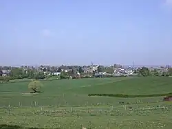
Ubachsberg
Ubachsberg | |
|---|---|
Village | |
 | |
 Ubachsberg Location in the Netherlands 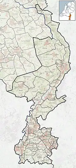 Ubachsberg Location in the province of Limburg in the Netherlands | |
| Coordinates: 50°51′10″N 5°56′50″E / 50.85278°N 5.94722°E | |
| Country | Netherlands |
| Province | Limburg |
| Municipality | Voerendaal |
| Area | |
• Total | 0.55 km2 (0.21 sq mi) |
| Elevation | 101 m (331 ft) |
| Population (2021)[1] | |
• Total | 1,430 |
| • Density | 2,600/km2 (6,700/sq mi) |
| Time zone | UTC+1 (CET) |
| • Summer (DST) | UTC+2 (CEST) |
| Postal code | 6367[1] |
| Dialing code | 045 |
Ubachsberg (Dutch pronunciation: [ˈybɑxsbɛr(ə)x]) is a village in the Dutch province of Limburg. It is located in the municipality of Voerendaal.[3]
The village was first mentioned in 1380 as "opten Berch", and means "hill of the Ubachs family".[4] Ubachsberg developed in the Early Middle Ages on the road from Simpelveld to Sittard.[5]
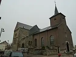
The Catholic St Bernardus Church is a neoclassic cruciform church built in 1842.[5]
Restaurant De Leuf (2 Michelin stars) is located in the village.[6]
-
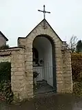 Chapel in the "Oude Schoolstraat"
 -
-
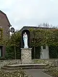 Maria statue Hunsstraat
 -
.JPG) Limekiln
Limekiln
References
- ^ a b c "Kerncijfers wijken en buurten 2021". Central Bureau of Statistics. Retrieved 26 April 2022.
- ^ "Postcodetool for 6367AA". Actueel Hoogtebestand Nederland (in Dutch). Het Waterschapshuis. Archived from the original on 21 September 2013. Retrieved 26 April 2022.
- ^ ANWB Topografische Atlas Nederland, Topografische Dienst and ANWB, 2005.
- ^ "Ubachsberg - (geografische naam)". Etymologiebank (in Dutch). Retrieved 26 April 2022.
- ^ a b Sabine Broekhoven, & Ronald Stenvert (2003). Ubachsberg (in Dutch). Zwolle: Waanders. ISBN 90 400 9623 6. Retrieved 26 April 2022.
- ^ (in Dutch) De Leuf