Ulicoten
Ulicoten | |
|---|---|
Village | |
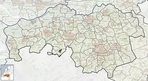 Ulicoten Location in the province of North Brabant in the Netherlands  Ulicoten Ulicoten (Netherlands) | |
| Coordinates: 51°27′25″N 4°51′25″E / 51.45694°N 4.85694°E | |
| Country | Netherlands |
| Province | North Brabant |
| Municipality | Baarle-Nassau |
| Area | |
• Total | 21.30 km2 (8.22 sq mi) |
| Elevation | 18 m (59 ft) |
| Population (2021)[1] | |
• Total | 1,090 |
| • Density | 51/km2 (130/sq mi) |
| Time zone | UTC+1 (CET) |
| • Summer (DST) | UTC+2 (CEST) |
| Postal code | 5113[1] |
| Dialing code | 013 |
Ulicoten is a village in the Dutch province of North Brabant. It is a part of the municipality of Baarle-Nassau and is situated about 16 kilometres (9.9 mi) south of Breda.
History
The village was first mentioned in 1422 as Ulencoete, and means "little house/farm on land near water"[3]
The Roman Catholic church was built during the early 19th century, but destroyed in 1944. In 1950, a new church was built with two towers.[4]
Ulicoten was home to 407 people in 1840.[4]
It has a single primary school, Bernardusschool.[5]
Gallery
-
_Roman_Catholic_Churchyard_-1.jpg) Catholic church of Ulicoten
Catholic church of Ulicoten -
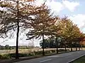 Street view
References
- ^ a b c "Kerncijfers wijken en buurten 2021". Central Bureau of Statistics. Retrieved 15 April 2022.
- ^ "Postcodetool for 5113BA". Actueel Hoogtebestand Nederland (in Dutch). Het Waterschapshuis. Archived from the original on 21 September 2013. Retrieved 15 April 2022.
- ^ "Ulicoten - (geografische naam)". Etymologiebank (in Dutch). Retrieved 15 April 2022.
- ^ a b "Ulicten". Plaatsengids (in Dutch). Retrieved 15 April 2022.
- ^ "Jeugd en Onderwijs". Baarle-Nassau. Retrieved 2022-01-18. - Under the tab "Onderwijs en kinderopvang"
Wikimedia Commons has media related to Ulicoten.