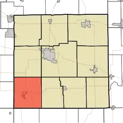
Union Township, Marshall County, Indiana
Union Township | |
|---|---|
 Location in Marshall County | |
| Coordinates: 41°13′24″N 86°24′25″W / 41.22333°N 86.40694°W | |
| Country | |
| State | |
| County | Marshall |
| Government | |
| • Type | Indiana township |
| Area | |
• Total | 43.95 sq mi (113.8 km2) |
| • Land | 40.8 sq mi (106 km2) |
| • Water | 3.16 sq mi (8.2 km2) 7.19% |
| Elevation | 771 ft (235 m) |
| Population | |
• Total | 2,771 |
| • Density | 75.7/sq mi (29.2/km2) |
| ZIP codes | 46511, 46563 |
| GNIS feature ID | 0453924 |
Union Township is one of ten townships in Marshall County, Indiana, United States. As of the 2020 census, its population was 2,771 (down from 3,088 at 2010[2]) and it contained 1,949 housing units.
History
Union Township was organized in 1840. It was likely named after Union County, Indiana, the former home of some of the early settlers.[3]
The East Shore Historic District and Norris Farm-Maxinkuckee Orchard are listed on the National Register of Historic Places.[4][5] Woodbank was delisted in 2014.[6]
Geography
According to the 2010 census, the township has a total area of 43.95 square miles (113.8 km2), of which 40.8 square miles (106 km2) (or 92.83%) is land and 3.16 square miles (8.2 km2) (or 7.19%) is water.[2]
Cities, towns, villages
Unincorporated towns
- Burr Oak at 41°15′23″N 86°24′55″W / 41.256431°N 86.415285°W
- Hibbard at 41°15′12″N 86°23′13″W / 41.253376°N 86.386951°W
- Maxinkuckee at 41°12′30″N 86°22′53″W / 41.208376°N 86.381395°W
- Rutland at 41°14′40″N 86°21′26″W / 41.244487°N 86.357228°W
(This list is based on USGS data and may include former settlements.)
Cemeteries
The township contains these five cemeteries: Burr Oak, Cromley, Masonic, Washington and Zion.
Airports and landing strips
- Culver Airport
- Fleet Field
- Jacks Field
Lakes
- Lake Maxinkuckee
- Houghton Lake
- Lost Lake
- Moore Lake
Major highways
Education
- Culver Community Schools Corporation
The township is served by the Culver-Union Township Public Library.[7]
Political districts
- Indiana's 2nd congressional district
- State House District 17
- State Senate District 5
References
- "Union Township, Marshall County, Indiana". Geographic Names Information System. United States Geological Survey, United States Department of the Interior. Retrieved September 29, 2009.
- United States Census Bureau 2008 TIGER/Line Shapefiles
- IndianaMap
- ^ "Census Bureau profile: Union Township, Marshall County, Indiana". United States Census Bureau. May 2023. Retrieved April 3, 2024.
- ^ a b "Population, Housing Units, Area, and Density: 2010 - County -- County Subdivision and Place -- 2010 Census Summary File 1". United States Census. Archived from the original on February 12, 2020. Retrieved May 10, 2013.
- ^ McDonald, Daniel (1908). A Twentieth Century History of Marshall County, Indiana, Volume 1. Lewis Publishing Company. p. 86.
- ^ "National Register Information System". National Register of Historic Places. National Park Service. July 9, 2010.
- ^ "National Register of Historic Places Listings" (PDF). Weekly List of Actions Taken on Properties: 6/06/16 through 6/10/16. National Park Service. June 17, 2016.
- ^ "National Register of Historic Places Listings" (PDF). Weekly List of Actions Taken on Properties: 9/01/14 through 9/05/14. National Park Service. September 12, 2014.
- ^ "Indiana public library directory" (PDF). Indiana State Library. Archived from the original (PDF) on February 18, 2017. Retrieved March 10, 2018.
External links
- Indiana Township Association
- United Township Association of Indiana
- City-Data.com page for Union Township
Places adjacent to Union Township, Marshall County, Indiana | |
|---|---|
Municipalities and communities of Marshall County, Indiana, United States | ||
|---|---|---|
| City | 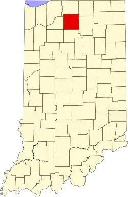 | |
| Towns | ||
| Townships | ||
| CDPs | ||
| Other communities | ||
| Footnotes | ‡This populated place also has portions in an adjacent county or counties | |