Union Township, Ohio County, Indiana
Union Township | |
|---|---|
 Location in Ohio County | |
| Coordinates: 38°59′16″N 84°58′01″W / 38.98778°N 84.96694°W | |
| Country | |
| State | |
| County | Ohio |
| Government | |
| • Type | Indiana township |
| Area | |
• Total | 11.61 sq mi (30.1 km2) |
| • Land | 11.52 sq mi (29.8 km2) |
| • Water | 0.09 sq mi (0.2 km2) 0.78% |
| Elevation | 623 ft (190 m) |
| Population (2020) | |
• Total | 447 |
| • Density | 39/sq mi (15/km2) |
| Time zone | UTC-5 (EST) |
| • Summer (DST) | UTC-4 (EDT) |
| ZIP codes | 47001, 47018, 47040 |
| Area codes | 812, 930 |
| GNIS feature ID | 453927 |
Union Township is one of four townships in Ohio County, Indiana, United States. As of the 2020 census, its population was 447, and it contained 203 housing units.[1]
| Census | Pop. | Note | %± |
|---|---|---|---|
| 1890 | 533 | — | |
| 1900 | 577 | 8.3% | |
| 1910 | 454 | −21.3% | |
| 1920 | 392 | −13.7% | |
| 1930 | 322 | −17.9% | |
| 1940 | 267 | −17.1% | |
| 1950 | 315 | 18.0% | |
| 1960 | 266 | −15.6% | |
| 1970 | 249 | −6.4% | |
| 1980 | 267 | 7.2% | |
| 1990 | 443 | 65.9% | |
| 2000 | 495 | 11.7% | |
| 2010 | 504 | 1.8% | |
| 2020 | 447 | −11.3% | |
| Source: US Decennial Census[2] | |||
Geography
According to the 2010 census, the township has a total area of 11.61 square miles (30.1 km2), of which 11.52 square miles (29.8 km2) (or 99.22%) is land and 0.09 square miles (0.23 km2) (or 0.78%) is water.[3] Union is the smallest township in the state by area.
Unincorporated towns
- Hartford at 38°59′35″N 84°57′25″W / 38.993114°N 84.956896°W
- Milton at 38°58′42″N 85°00′52″W / 38.978392°N 85.014397°W
(This list is based on USGS data and may include former settlements.)
School districts
- Rising Sun-Ohio County Community Schools
Political districts
- State House District 68
- State Senate District 43
References
- "Union Township, Ohio County, Indiana". Geographic Names Information System. United States Geological Survey, United States Department of the Interior. Retrieved October 22, 2009.
- United States Census Bureau 2009 TIGER/Line Shapefiles
- IndianaMap
- ^ "Explore Census Data". data.census.gov. Retrieved April 10, 2024.
- ^ "Township Census Counts: STATS Indiana".
- ^ "Population, Housing Units, Area, and Density: 2010 - County -- County Subdivision and Place -- 2010 Census Summary File 1". United States Census. Archived from the original on February 12, 2020. Retrieved May 10, 2013.
External links
- Indiana Township Association
- United Township Association of Indiana
- City-Data.com page for Union Township
Places adjacent to Union Township, Ohio County, Indiana | |
|---|---|
Municipalities and communities of Ohio County, Indiana, United States | ||
|---|---|---|
| City | 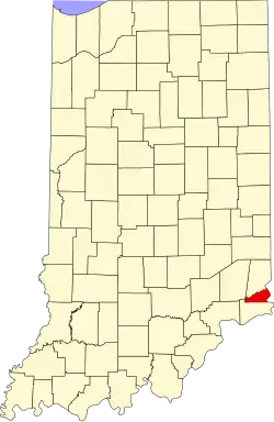 | |
| Townships | ||
| Unincorporated communities | ||