Untermaßfeld
Untermaßfeld | |
|---|---|
 Coat of arms | |
Location of Untermaßfeld within Schmalkalden-Meiningen district 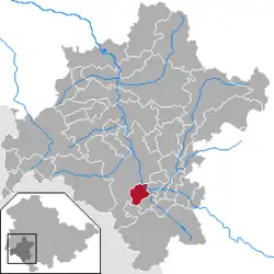 | |
 Untermaßfeld  Untermaßfeld | |
| Coordinates: 50°32′N 10°25′E / 50.533°N 10.417°E | |
| Country | Germany |
| State | Thuringia |
| District | Schmalkalden-Meiningen |
| Government | |
| • Mayor (2022–28) | Michael Trampler[1] |
| Area | |
• Total | 10.79 km2 (4.17 sq mi) |
| Elevation | 295 m (968 ft) |
| Population (2024-12-31)[2] | |
• Total | 1,220 |
| • Density | 110/km2 (290/sq mi) |
| Time zone | UTC+01:00 (CET) |
| • Summer (DST) | UTC+02:00 (CEST) |
| Postal codes | 98617 |
| Dialling codes | 036949 |
| Vehicle registration | SM |
Untermaßfeld is a municipality in the district Schmalkalden-Meiningen, in Thuringia, Germany.
References
- ^ Gewählte Bürgermeister - aktuelle Landesübersicht, Freistaat Thüringen, accessed 10 November 2022.
- ^ "Bevölkerung der Gemeinden vom Thüringer Landesamt für Statistik" (in German). Thüringer Landesamt für Statistik.