Urukh
| Urukh | |
|---|---|
 | |
  | |
| Location | |
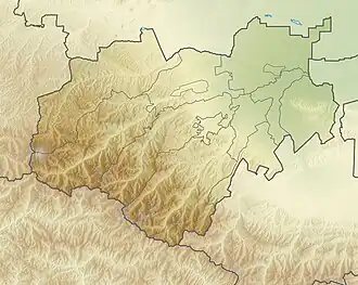
| Country | Russia |
| Federal subjects | North Ossetia–Alania, Kabardino-Balkaria |
| Physical characteristics | |
| Source | |
| • location | Greater Caucasus |
| Mouth | Terek |
• coordinates | 43°27′22″N 44°06′26″E / 43.45611°N 44.10722°E |
| Length | 104 km (65 mi) |
| Basin size | 1,280 km2 (490 sq mi) |
| Basin features | |
| Progression | Terek→ Caspian Sea |
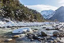
The Urukh (Russian: Урух, Ossetian: Ирӕф / Ӕрӕф, romanized: Irӕf / Ӕrӕf), known as Kharves in its upper reaches,[1] is a river in North Ossetia–Alania and Kabardino-Balkaria (Russia), which flows northeast to join the Terek as a left tributary northwest of Vladikavkaz. The length of the Urukh is 104 km, the area of its drainage basin is 1280 km².[2] The Urukh originates in the glaciers of the Greater Caucasus.[1] The river freezes up in December and remains icebound until March.
References
- ^ a b Урух, Great Soviet Encyclopedia
- ^ "Река Урух (Харвес) in the State Water Register of Russia". textual.ru (in Russian).