Vega de Palma
Vega de Palma | |
|---|---|
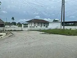
Rural settlement | |
 Train station of Vega de Palma | |
 Former ward of Vega de Palma (red) seen in Villa Clara Province | |
.svg.png) Vega de Palma 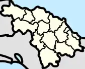 Vega de Palma  Vega de Palma | |
| Coordinates: 22°29′26″N 79°41′34″W / 22.49056°N 79.69278°W | |
| Country | Cuba |
| Province | Villa Clara |
| Municipality | Camajuaní |
| Ward | San Antonio de las Vueltas |
| Foundation | 1878 |
| Area | |
| • Land | 0.48 km2 (0.19 sq mi) |
| Population (14 September 2012)[1] | |
• Total | 1,506 |
Vega de Palma is a rural settlement[1] located on the Circuito Norte in Camajuaní, Cuba. The town is a part of the ward of San Antonio de las Vueltas and It is located five kilometers south of the town of San Antonio de las Vueltas.[2]
History
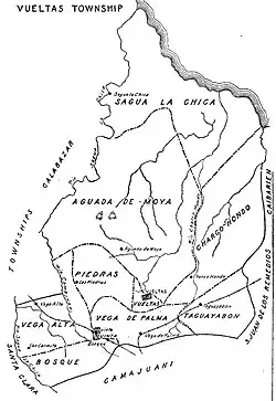
The town was founded in 1878 as a train stop, as a part of the former municipality of San Antonio de las Vueltas. It was also a barrio of the former municipality.[2]
Geography
The settlement in located in the ward of San Antonio de las Vueltas, on the Circuito Norte. It has a railroad which links it from Camajuaní in the west to Remedios and Caibarién in the east.[3]
Education
Vega de Palma has the Escuela Primaria (Primary School) Pity Fajardo, named after Manuel Fajardo.[4]
References
- ^ a b c "Vega de Palma (Camajuaní, Villa Clara Province, Cuba) - Population Statistics, Charts, Map, Location, Weather and Web Information". citypopulation.de. Retrieved 2024-08-25.
- ^ a b "San Antonio de las Vueltas". www.guije.com. Retrieved 2025-06-30.
- ^ "Node: Vega de Palma (4320533403)". OpenStreetMap. 2016-07-26. Retrieved 2024-08-25.
- ^ "Portal del Ciudadano en Camajuaní - Educación". 2024-07-12. Archived from the original on 2024-07-12. Retrieved 2024-08-25.