Vermilion Range (British Columbia)
| Vermilion Range | |
|---|---|
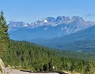 View from Highway 93 looking north at Mt. Verendrye (center) and Mt. Wardle (right) | |
| Highest point | |
| Peak | Foster Peak |
| Elevation | 3,204 m (10,512 ft)[1] |
| Prominence | 996 m (3,268 ft)[2] |
| Listing | Mountains of British Columbia |
| Coordinates | 51°03′56″N 116°09′51″W / 51.06556°N 116.16417°W[3] |
| Dimensions | |
| Length | 46 km (29 mi) N-S[4] |
| Width | 33 km (21 mi) E-W[4] |
| Area | 568 km2 (219 sq mi)[4] |
| Geography | |
 Vermilion Range Location in SE British Columbia | |
| Country | Canada |
| Province | British Columbia |
| District | Kootenay Land District[5] |
| Range coordinates | 51°05′N 116°05′W / 51.083°N 116.083°W[6] |
| Parent range | Park Ranges |
| Topo map | NTS 82N1 Mount Goodsir[6] |
The Vermilion Range is a mountain range of the Canadian Rockies, in British Columbia, Canada. The range is west of the Vermilion River and east of the headwaters of the Kootenay River.[5]
List of mountains
This range includes the following mountains and peaks:[4]
| Name | Elevation | Prominence | Coordinates | ||
|---|---|---|---|---|---|
| m | ft | m | ft | ||
| Foster Peak | 3,204 | 10,512 | 996 | 3,268 | 51°3′56″N 116°9′51″W / 51.06556°N 116.16417°W |
| Tumbling Peak | 3,145 | 10,318 | 685 | 2,247 | 51°6′34″N 116°13′57″W / 51.10944°N 116.23250°W |
| Mount Verendrye | 3,085 | 10,121 | 515 | 1,690 | 51°0′20″N 116°4′31″W / 51.00556°N 116.07528°W |
| Hewitt Peak | 3,066 | 10,059 | 548 | 1,798 | 51°5′31″N 116°12′39″W / 51.09194°N 116.21083°W |
| Floe Peak | 3,006 | 9,862 | 436 | 1,430 | 51°2′33″N 116°8′32″W / 51.04250°N 116.14222°W |
| Mount Drysdale | 2,932 | 9,619 | 162 | 531 | 51°9′0.0″N 116°16′22.8″W / 51.150000°N 116.273000°W |
| Mount Gray | 2,886 | 9,469 | 136 | 446 | 51°7′46″N 116°15′47″W / 51.12944°N 116.26306°W |
| Limestone Peak | 2,878 | 9,442 | 51 | 167 | 51°11′0″N 116°17′53″W / 51.18333°N 116.29806°W |
| Mount Wardle | 2,805 | 9,203 | 362 | 1,188 | 50°57′33″N 116°1′12″W / 50.95917°N 116.02000°W |
| Numa Mountain[7] | 2,721 | 8,927 | 391 | 1,283 | |
References
- ^ "Topographic map of Foster Peak". opentopomap.org. Retrieved 2023-07-12.
- ^ "Foster Peak". Bivouac.com. Retrieved 2021-07-30.
- ^ "Foster Peak, Kootenay Land District". Geographical Names Data Base. Natural Resources Canada. Retrieved 2021-07-30.
- ^ a b c d "Vermillion Range". Peakbagger.com. Retrieved 2021-07-30.
- ^ a b "Vermilion Range". BC Geographical Names. Retrieved 2021-07-30.
- ^ a b "Vermilion Range". Geographical Names Data Base. Natural Resources Canada. Retrieved 2021-07-30.
- ^ "Numa Mountain". Bivouac.com. Retrieved 2024-10-23.