Verzée
| Verzée | |
|---|---|
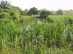 Verzée river, in Pouancé | |
  | |
| Location | |
| Country | France |
| Physical characteristics | |
| Source | |
| • location | Soudan |
| • coordinates | 47°45′39″N 01°19′41″W / 47.76083°N 1.32806°W |
| • elevation | 95 m (312 ft) |
| Mouth | |
• location | Oudon |
• coordinates | 47°41′09″N 00°52′11″W / 47.68583°N 0.86972°W |
• elevation | 25 m (82 ft) |
| Length | 52.1 km (32.4 mi) |
| Basin size | 410 km2 (160 sq mi) |
| Discharge | |
| • average | 2.1 m3/s (74 cu ft/s) |
| Basin features | |
| Progression | Oudon→ Mayenne→ Maine→ Loire→ Atlantic Ocean |
The Verzée (French pronunciation: [vɛʁze]) is a 52.1-kilometre-long (32.4 mi) river in the Loire-Atlantique and Maine-et-Loire départements, western France.[1] Its source is at Soudan. It flows generally east-southeast. It is a right tributary of the Oudon into which it flows at Segré.
Communes along its course
This list is ordered from source to mouth:
- Loire-Atlantique: Soudan, Noyal-sur-Brutz, Villepot
- Maine-et-Loire: Pouancé, La Prévière, Armaillé, Noëllet, Le Tremblay, Combrée, Le Bourg-d'Iré, Noyant-la-Gravoyère, Sainte-Gemmes-d'Andigné, Segré
References