Vilcas Huamán District
Vilcas Huamán
Willka Waman | |
|---|---|
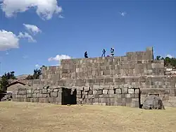 Usnu in Vilcas Huamán | |
| Country | |
| Region | Ayacucho |
| Province | Vilcas Huamán |
| Founded | February 1, 1944 |
| Capital | Vilcas Huamán |
| Area | |
• Total | 216.89 km2 (83.74 sq mi) |
| Elevation | 3,470 m (11,380 ft) |
| Population | |
• Total | 8,406 |
| • Density | 39/km2 (100/sq mi) |
| Time zone | UTC-5 (PET) |
| UBIGEO | 051101 |
Vilcas Huamán or Vilcas Guamán (from Quechua Willka Waman) is one of eight districts of the Vilcas Huamán Province in Peru.[1]
Geography
One of the highest mountains of the district is Qutu Pukyu at approximately 4,000 m (13,000 ft). Other mountains are listed below:[2]
- Anta Qaqa
- Awkillana
- Chumpiq
- Hatun
- Maknu Q'asa
- Pilluchu
- Puka Q'asa
- Qullpa Muqu
- Ranra
- Tiklla Rasu
- Urqu Pata
- Urqun Wasi
- Wayra Q'asa
Ethnic groups
The people in the district are mainly indigenous citizens of Quechua descent. Quechua is the language which the majority of the population (87.91%) learnt to speak in childhood, 11.78% of the residents started speaking using the Spanish language (2007 Peru Census).[3]
See also
References
- ^ (in Spanish) Instituto Nacional de Estadística e Informática. Banco de Información Distrital Archived April 23, 2008, at the Wayback Machine. Retrieved April 11, 2008.
- ^ escale.minedu.gob.pe - UGEL maps of the Vilcas Huamán Province 2, Ayacucho Region
- ^ inei.gob.pe Archived January 27, 2013, at the Wayback Machine INEI, Peru, Censos Nacionales 2007, Frequencias: Preguntas de Población: Idioma o lengua con el que aprendió hablar (in Spanish)
Wikimedia Commons has media related to Vilcas Huamán District.
| |
|---|---|
| Cangallo | |
| Huamanga | |
| Huanca Sancos | |
| Huanta | |
| La Mar | |
| Lucanas | |
| Parinacochas | |
| Paucar del Sara Sara | |
| Sucre | |
| Víctor Fajardo | |
| Vilcas Huamán | |
13°39′15″S 73°57′27″W / 13.6541°S 73.9576°W