Waco Township, Sedgwick County, Kansas
Waco Township Sedgwick County, Kansas | |
|---|---|
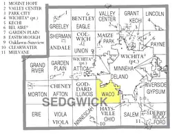 Location within Sedgwick County | |
 Waco Township Location within state of Kansas | |
| Coordinates: 37°36′30″N 97°25′31″W / 37.60833°N 97.42528°W[1] | |
| Country | United States |
| State | Kansas |
| County | Sedgwick |
| Area | |
• Total | 28.90 sq mi (74.9 km2) |
| • Land | 28.86 sq mi (74.7 km2) |
| • Water | 0.04 sq mi (0.1 km2) |
| Elevation | 1,309 ft (399 m) |
| Population (2000) | |
• Total | 3,381 |
| • Density | 120/sq mi (45/km2) |
| Time zone | UTC-6 (CST) |
| • Summer (DST) | UTC-5 (CDT) |
| Area code | 620 |
| FIPS code | 20-74300 [1] |
| GNIS ID | 474181 [1] |
Waco Township is a township in Sedgwick County, Kansas, United States.[1] As of the 2000 United States census, it had a population of 3,381.[2]
References
- ^ a b c d e "Waco Township, Sedgwick County, Kansas", Geographic Names Information System, United States Geological Survey, United States Department of the Interior
- ^ "Kansas: 2000 Population and Housing Counts" (PDF). United States Census Bureau. July 2003. p. 27. Retrieved January 16, 2011.
Further reading
External links
Municipalities and communities of Sedgwick County, Kansas, United States | ||
|---|---|---|
| Cities |  | |
| CDPs | ||
| Unincorporated communities | ||
| Townships | ||
| Footnotes | ‡This community also has portions in an adjacent county or counties. | |