Walem, Netherlands
Walem | |
|---|---|
Hamlet | |
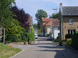 Street view | |
 Walem Location in the Netherlands 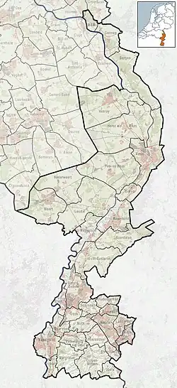 Walem Location in the province of Limburg in the Netherlands | |
| Coordinates: 50°52′7″N 5°52′7″E / 50.86861°N 5.86861°E | |
| Country | Netherlands |
| Province | Limburg |
| Municipality | Valkenburg aan de Geul |
| Area | |
• Total | 0.86 km2 (0.33 sq mi) |
| Elevation | 115 m (377 ft) |
| Population (2021)[1] | |
• Total | 160 |
| • Density | 190/km2 (480/sq mi) |
| Time zone | UTC+1 (CET) |
| • Summer (DST) | UTC+2 (CEST) |
| Postal code | 6342[1] |
| Dialing code | 043 |
Walem is a hamlet with about 200 inhabitants in the Dutch province of Limburg. It is largely in the municipality of Valkenburg aan de Geul, but a small part lies in Voerendaal.
It was first mentioned in 1360 as Walheym, and means "settlement of the Walloons".[3]
Walem has place name signs. It was home to 167 people in 1840.[4]
Gallery
-
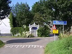 Place name, with in the background the Mary Chapel.
References
- ^ a b c "Kerncijfers wijken en buurten 2021". Central Bureau of Statistics. Retrieved 26 April 2022.
- ^ "Postcodetool for 6342AA". Actueel Hoogtebestand Nederland (in Dutch). Het Waterschapshuis. Archived from the original on 24 December 2018. Retrieved 26 April 2022.
- ^ "Walem - (geografische naam)". Etymologiebank (in Dutch). Retrieved 26 April 2022.
- ^ "Walem". Plaatsengids (in Dutch). Retrieved 26 April 2022.
Wikimedia Commons has media related to Walem (Limburg).