Walpersbach
Walpersbach | |
|---|---|
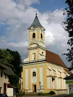 Walpersbach parish church | |
 Coat of arms | |
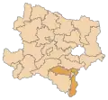
 Walpersbach Location within Austria | |
| Coordinates: 47°43′00″N 16°14′00″E / 47.71667°N 16.23333°E | |
| Country | Austria |
| State | Lower Austria |
| District | Wiener Neustadt-Land |
| Government | |
| • Mayor | Franz Breitsching (ÖVP) |
| Area | |
• Total | 16.46 km2 (6.36 sq mi) |
| Elevation | 317 m (1,040 ft) |
| Population (2018-01-01)[2] | |
• Total | 1,125 |
| • Density | 68/km2 (180/sq mi) |
| Time zone | UTC+1 (CET) |
| • Summer (DST) | UTC+2 (CEST) |
| Postal code | 2822 |
| Area code | 02627 |
| Vehicle registration | WB |
| Website | www.walpersbach.gv.at |
Walpersbach is a municipality in the district of Wiener Neustadt-Land in the Austrian state of Lower Austria.
Geography
Walpersbach is in the Industrieviertel (industrial area) of Lower Austria. Its cadastral communities are Klingfurth, Schleinz and Walpersbach.
Population
| Year | Pop. | ±% |
|---|---|---|
| 1971 | 1,016 | — |
| 1981 | 945 | −7.0% |
| 1991 | 989 | +4.7% |
| 2001 | 1,048 | +6.0% |
| 2010 | 1,062 | +1.3% |
Politics
The mayor of the municipality is Franz Breitsching, and its chief officer is Elisabeth Hafenscher.
References
- ^ "Dauersiedlungsraum der Gemeinden Politischen Bezirke und Bundesländer - Gebietsstand 1.1.2018". Statistics Austria. Retrieved 10 March 2019.
- ^ "Einwohnerzahl 1.1.2018 nach Gemeinden mit Status, Gebietsstand 1.1.2018". Statistics Austria. Retrieved 9 March 2019.