West-Terschelling
West-Terschelling
West-Skylge | |
|---|---|
Village | |
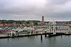 View from the harbour | |
 Location of the village on Terschelling | |
 West-Terschelling Location in the Netherlands | |
| Coordinates: 53°21′39″N 5°12′56″E / 53.36083°N 5.21556°E | |
| Country | |
| Province | |
| Municipality | |
| Population (1 January 2017) | |
• Total | 2,602 |
| Time zone | UTC+1 (CET) |
| • Summer (DST) | UTC+2 (CEST) |
| Postal code | 8881 |
| Dialing code | 0562 |
West-Terschelling (West Frisian: West-Skylge) is the largest village on Terschelling in the province Friesland, the Netherlands. It had a population of around 2,602 in January 2017.[1]
The skyline of the village is dominated by the Brandaris lighthouse, the village had also been named Sint Brandariusparochie, Sint-Brandariuskerke and just Brandaris in earlier centuries.
History
The town was partially burned on the order of Sir Robert Holmes in 1666, during the Second Anglo-Dutch War, in an event referred to as "Holmes's Bonfire".
A pub was named after the Oka 18, a ship that sank near Formerum.
Museums and monuments
West Terschelling has 110 rijksmonuments.[2]
There is a museum about the last voyage of Willem Barentsz, 't Behouden Huys.[3]
Gallery
-
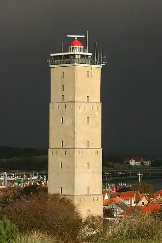 Brandaris lighthouse
 -
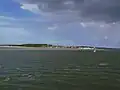 West-Terschelling, view facing the town (from far distance)
 -
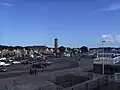 West-Terschelling, view facing the town (from the port)
 -
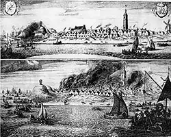 The town being burnt during Holmes's Bonfire
 -
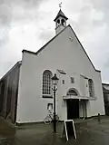 West Church
Sources
- Municipality guide Terschelling 2005-2006
References
- ^ Bevolkingscijfers - Terschelling (in Dutch)
- ^ "Rijksdienst voor het Cultureel Erfgoed". Rijksdienst voor het Cultureel Erfgoed (in Dutch). Retrieved 2020-02-08.
- ^ "Museum 't Behouden Huys | Museum 't Behouden Huys". behouden-huys.nl. Retrieved 2020-02-08.