West Kettle River
| West Kettle River | |
|---|---|
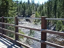 West Kettle River as seen from the Kettle Valley Rail Trail | |
| Location | |
| Country | Canada |
| Province | British Columbia |
| Land District | Similkameen Division Yale |
| Physical characteristics | |
| Source | St Margaret Lake |
| • location | North of Big White Ski Resort |
| • coordinates | 49°56′56″N 118°50′57″W / 49.94889°N 118.84917°W |
| • elevation | 1,974 m (6,476 ft)[2] |
| Mouth | Kettle River |
• location | Westbridge |
• coordinates | 49°09′58″N 118°58′22″W / 49.16611°N 118.97278°W |
• elevation | 625 m (2,051 ft)[3] |
| Discharge | |
| • location | At Westbridge[1] |
| • average | 9.24 m3/s (326 cu ft/s)[1] |
| • minimum | 0.991 m3/s (35.0 cu ft/s) |
| • maximum | 198 m3/s (7,000 cu ft/s) |
The West Kettle River is a tributary of the Kettle River in the Canadian province of British Columbia.[4] It is part of the Columbia River basin, as the Kettle River is a tributary of the Columbia River.
Course
The West Kettle River originates in St Margaret Lake[5] the mountains east of Kelowna, near Jubilee Mountain. The river flows generally south, joining the Kettle River near the community of Westbridge.
See also
References
- ^ a b "Archived Hydrometric Data Search". Water Survey of Canada. Retrieved October 19, 2008. Search for Station 08NN003 West Kettle River at Westbridge
- ^ Source elevation derived from Google Earth.
- ^ Mouth elevation derived from Google Earth.
- ^ "West Kettle River". BC Geographical Names.
- ^ "St Margaret Lake". BC Geographical Names.