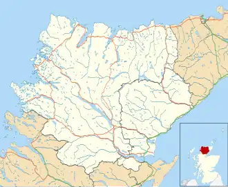
West Langwell
| West Langwell | |
|---|---|
 | |
 West Langwell Location within the Sutherland area | |
| OS grid reference | NC719095 |
| Council area | |
| Lieutenancy area | |
| Country | Scotland |
| Sovereign state | United Kingdom |
| Post town | Rogart |
| Postcode district | IV28 3 |
| Police | Scotland |
| Fire | Scottish |
| Ambulance | Scottish |
West Langwell is a small crofting settlement in Rogart, Sutherland is in the Scottish council area of Highland within the Scottish Highlands.[1][2] The village of East Langwell lies 2 miles (3 km) directly southeast of West Langwell, and approximately 8 miles (13 km) north of Golspie.
Gallery
-
 Abhainn Srath na Seilge View towards Creag Dhubh Dail nan Gillean across Srath na Seilge.
 -
 Abhainn Srath na Seilge or Black Water The river has now changed its name on the 1:25,000 map to Black Water. The river drains a large area of Ben Armine Forest and there is only one bridge upstream of here.
 -
 Acheilidh from above Looking down on the houses of Acheilidh and the level crossing
 -
 Braegrudie Only a footbridge leads to this remote croft
 -
 Craigton. Isolated, but still inhabited house in Strath Brora
 -
 West Langwell. From the road.
 -
 Looking up the Brora from Braegrudie
 -
 Split rocks at Braegrudie
References
- ^ Microsoft; Nokia. "West Langwell" (Map). Bing Maps. Microsoft. Retrieved 14 October 2017.
- ^ Gittings, Bruce; Munro, David. "West Langwell , Highland". The Gazetteer for Scotland. School of GeoSciences, University of Edinburgh and The Royal Scottish Geographical Society. Retrieved 19 October 2020.