Westbury, Quebec
Westbury | |
|---|---|
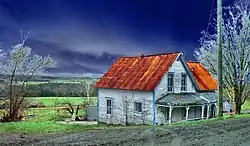 Old house in Westbury | |
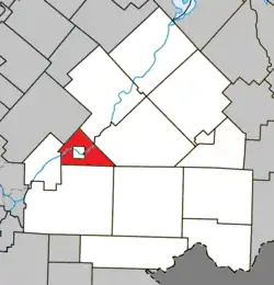 Location within Le Haut-Saint-François RCM | |
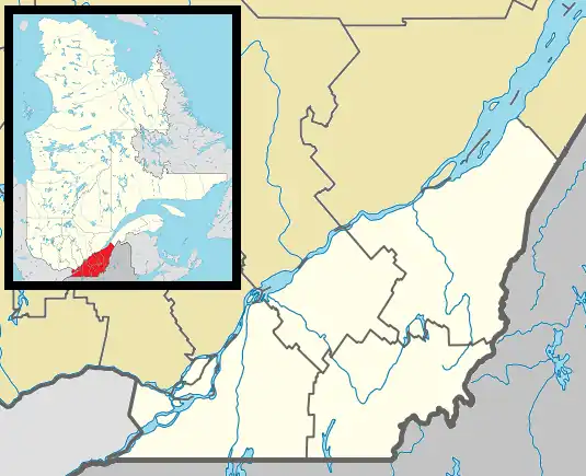 Westbury Location in southern Quebec | |
| Coordinates: 45°30′N 71°40′W / 45.5°N 71.67°W[1] | |
| Country | |
| Province | |
| Region | Estrie |
| RCM | Le Haut-Saint-François |
| Constituted | August 16, 1858 |
| Government | |
| • Mayor | Gray Forster |
| • Federal riding | Compton—Stanstead |
| • Prov. riding | Mégantic |
| Area | |
• Total | 57.30 km2 (22.12 sq mi) |
| • Land | 55.61 km2 (21.47 sq mi) |
| Population | |
• Total | 1,097 |
| • Density | 19.7/km2 (51/sq mi) |
| • Pop 2016-2021 | |
| Time zone | UTC−5 (EST) |
| • Summer (DST) | UTC−4 (EDT) |
| Postal code(s) | |
| Area code | 819 |
| Highways | |
| Website | www |
Westbury is a township municipality in Le Haut-Saint-François Regional County Municipality, in Quebec, Canada. It surrounds the city of East Angus.
The township had a population of 1,097 in the Canada 2021 Census.
Demographics
In the 2021 Census of Population conducted by Statistics Canada, Westbury had a population of 1,097 living in 424 of its 440 total private dwellings, a change of 9% from its 2016 population of 1,006. With a land area of 55.61 km2 (21.47 sq mi), it had a population density of 19.7/km2 (51.1/sq mi) in 2021.[4]
References
- ^ "Banque de noms de lieux du Québec: Reference number 66945". toponymie.gouv.qc.ca (in French). Commission de toponymie du Québec.
- ^ a b "Répertoire des municipalités: Geographic code 41065". www.mamh.gouv.qc.ca (in French). Ministère des Affaires municipales et de l'Habitation.
- ^ a b "Census Profile, 2021 Census - Westbury, Canton (Municipalité de), Quebec". 15 November 2023.
- ^ "Population and dwelling counts: Canada, provinces and territories, and census subdivisions (municipalities), Quebec". Statistics Canada. February 9, 2022. Retrieved August 28, 2022.
External links
 Media related to Westbury, Quebec at Wikimedia Commons
Places adjacent to Westbury, Quebec | |
|---|---|
| Cities & towns | |
|---|---|
| Municipalities | |
| Townships | |
| |