Westmoreland (CDP), New York
Westmoreland, New York | |
|---|---|
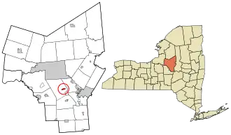 Location in Oneida County and the state of New York. | |
 Westmoreland, New York Location in the United States | |
| Coordinates: 43°6′54.4550″N 75°24′9.2970″W / 43.115126389°N 75.402582500°W | |
| Country | United States |
| State | New York |
| County | Oneida |
| Area | |
• Total | 0.71 sq mi (1.85 km2) |
| • Land | 0.71 sq mi (1.85 km2) |
| • Water | 0.00 sq mi (0.00 km2) |
| Population (2020) | |
• Total | 390 |
| • Density | 545.45/sq mi (210.58/km2) |
| Time zone | UTC-5 (Eastern (EST)) |
| • Summer (DST) | UTC-4 (EDT) |
| Area code | 315 |
| FIPS code | 36-80522 |
Westmoreland is a census-designated place in the town of Westmoreland in Oneida County, New York, United States.
Westmoreland is part of the Utica–Rome Metropolitan Statistical Area.
Geography
Demographics
| Census | Pop. | Note | %± |
|---|---|---|---|
| 2020 | 390 | — | |
| U.S. Decennial Census[2] | |||
References
- ^ "ArcGIS REST Services Directory". United States Census Bureau. Retrieved September 20, 2022.
- ^ "Census of Population and Housing". Census.gov. Retrieved June 4, 2016.
Municipalities and communities of Oneida County, New York, United States | ||
|---|---|---|
| Cities |  | |
| Towns | ||
| Villages | ||
| CDPs | ||
| Hamlets | ||