Weteringbrug
Weteringbrug | |
|---|---|
Village | |
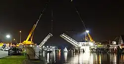 The bridge at Weteringburg | |
 Weteringbrug Location in the Netherlands 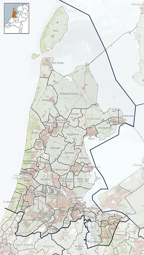 Weteringbrug Location in the province of North Holland in the Netherlands | |
| Coordinates: 52°13′N 4°39′E / 52.217°N 4.650°E | |
| Country | Netherlands |
| Province | North Holland |
| Municipality | Haarlemmermeer |
| Area | |
• Total | 2.59 km2 (1.00 sq mi) |
| Elevation | −3.2 m (−10.5 ft) |
| Population (2021)[1] | |
• Total | 375 |
| • Density | 140/km2 (370/sq mi) |
| Time zone | UTC+1 (CET) |
| • Summer (DST) | UTC+2 (CEST) |
| Postal code | 2156[1] |
| Dialing code | 071 |
Weteringbrug is a village in the Dutch province of North Holland. It is a part of the municipality of Haarlemmermeer, and lies about 9 km north of Alphen aan den Rijn.
The village was first mentioned in 1936 as Weteringbuurt. The current name means "bridge of the Oude Wetering (river)".[3]
Gallery
-
 House in Weteringbrug
 -
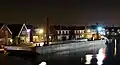 Canal view at night
References
- ^ a b c "Kerncijfers wijken en buurten 2021". Central Bureau of Statistics. Retrieved 30 April 2022.
- ^ "Postcodetool for 2156LA". Actueel Hoogtebestand Nederland (in Dutch). Het Waterschapshuis. Retrieved 30 April 2022.
- ^ "Weteringbrug". Etymologiebank (in Dutch). Retrieved 30 April 2022.