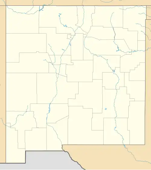
White Signal, New Mexico
White Signal, New Mexico | |
|---|---|
 White Signal  White Signal | |
| Coordinates: 32°34′05″N 108°21′45″W / 32.56806°N 108.36250°W | |
| Country | United States |
| State | New Mexico |
| County | Grant |
| Area | |
• Total | 6.44 sq mi (16.68 km2) |
| • Land | 6.43 sq mi (16.66 km2) |
| • Water | 0.01 sq mi (0.02 km2) |
| Elevation | 6,030 ft (1,840 m) |
| Population | |
• Total | 191 |
| • Density | 29.69/sq mi (11.46/km2) |
| Time zone | UTC-7 (Mountain (MST)) |
| • Summer (DST) | UTC-6 (MDT) |
| Area code | 575 |
| GNIS feature ID | 2584238[2] |
White Signal is a census-designated place in Grant County, New Mexico, United States. Its population was 181 as of the 2010 census.[4] New Mexico State Road 90 passes through the community.
White Signal was named for a nearby outcropping of reflective white quartz; early residents thought the reflected sunlight resembled a signal. The community had a post office from 1909 to 1933.[5]
Geography
According to the U.S. Census Bureau, the community has an area of 6.442 square miles (16.68 km2); 6.433 square miles (16.66 km2) of its area is land and 0.009 square miles (0.023 km2) is water.[4]
Climate
According to the Köppen Climate Classification system, White Signal has a cold semi-arid climate, abbreviated "BSk" on climate maps. The hottest temperature recorded in White Signal was 104 °F (40.0 °C) on June 20, 1960, while the coldest temperature recorded was −18 °F (−27.8 °C) on January 11, 1962.[6]
| Climate data for White Signal, New Mexico, 1991–2020 normals, extremes 1960–present | |||||||||||||
|---|---|---|---|---|---|---|---|---|---|---|---|---|---|
| Month | Jan | Feb | Mar | Apr | May | Jun | Jul | Aug | Sep | Oct | Nov | Dec | Year |
| Record high °F (°C) | 74 (23) |
82 (28) |
81 (27) |
88 (31) |
96 (36) |
104 (40) |
102 (39) |
100 (38) |
98 (37) |
93 (34) |
79 (26) |
72 (22) |
104 (40) |
| Mean maximum °F (°C) | 62.3 (16.8) |
65.7 (18.7) |
73.3 (22.9) |
79.3 (26.3) |
87.2 (30.7) |
95.1 (35.1) |
94.9 (34.9) |
91.0 (32.8) |
87.1 (30.6) |
81.7 (27.6) |
71.3 (21.8) |
63.6 (17.6) |
96.9 (36.1) |
| Mean daily maximum °F (°C) | 52.8 (11.6) |
56.4 (13.6) |
63.4 (17.4) |
71.3 (21.8) |
79.6 (26.4) |
88.6 (31.4) |
87.9 (31.1) |
85.5 (29.7) |
80.6 (27.0) |
72.2 (22.3) |
60.7 (15.9) |
52.0 (11.1) |
70.9 (21.6) |
| Daily mean °F (°C) | 39.6 (4.2) |
42.8 (6.0) |
48.1 (8.9) |
55.2 (12.9) |
63.7 (17.6) |
73.3 (22.9) |
74.8 (23.8) |
72.8 (22.7) |
67.1 (19.5) |
57.4 (14.1) |
46.5 (8.1) |
39.1 (3.9) |
56.7 (13.7) |
| Mean daily minimum °F (°C) | 26.5 (−3.1) |
29.2 (−1.6) |
32.9 (0.5) |
39.2 (4.0) |
47.9 (8.8) |
58.1 (14.5) |
61.8 (16.6) |
60.0 (15.6) |
53.5 (11.9) |
42.7 (5.9) |
32.3 (0.2) |
26.2 (−3.2) |
42.5 (5.8) |
| Mean minimum °F (°C) | 12.3 (−10.9) |
15.0 (−9.4) |
19.0 (−7.2) |
24.2 (−4.3) |
33.2 (0.7) |
43.3 (6.3) |
50.7 (10.4) |
50.2 (10.1) |
41.4 (5.2) |
26.8 (−2.9) |
16.9 (−8.4) |
10.4 (−12.0) |
7.8 (−13.4) |
| Record low °F (°C) | −18 (−28) |
1 (−17) |
5 (−15) |
17 (−8) |
21 (−6) |
27 (−3) |
38 (3) |
37 (3) |
32 (0) |
10 (−12) |
5 (−15) |
−10 (−23) |
−18 (−28) |
| Average precipitation inches (mm) | 1.10 (28) |
1.06 (27) |
0.59 (15) |
0.30 (7.6) |
0.38 (9.7) |
0.58 (15) |
3.30 (84) |
2.74 (70) |
1.60 (41) |
1.06 (27) |
1.00 (25) |
1.50 (38) |
15.21 (387.3) |
| Average snowfall inches (cm) | 4.2 (11) |
1.9 (4.8) |
1.0 (2.5) |
0.2 (0.51) |
0.0 (0.0) |
0.0 (0.0) |
0.0 (0.0) |
0.0 (0.0) |
0.0 (0.0) |
0.1 (0.25) |
1.1 (2.8) |
4.6 (12) |
13.1 (33.86) |
| Average precipitation days (≥ 0.01 in) | 4.8 | 5.2 | 3.3 | 1.7 | 2.3 | 3.0 | 10.1 | 10.0 | 5.7 | 4.2 | 3.3 | 5.0 | 58.6 |
| Average snowy days (≥ 0.1 in) | 1.9 | 1.3 | 0.9 | 0.2 | 0.0 | 0.0 | 0.0 | 0.0 | 0.0 | 0.1 | 0.5 | 1.8 | 6.7 |
| Source 1: NOAA[7] | |||||||||||||
| Source 2: National Weather Service[6] | |||||||||||||
Demographics
| Census | Pop. | Note | %± |
|---|---|---|---|
| 2020 | 191 | — | |
| U.S. Decennial Census[8][3] | |||
References
- ^ "ArcGIS REST Services Directory". United States Census Bureau. Retrieved October 12, 2022.
- ^ a b U.S. Geological Survey Geographic Names Information System: White Signal, New Mexico
- ^ a b "Census Population API". United States Census Bureau. Retrieved October 12, 2022.
- ^ a b "2010 Census Gazetteer Files - Places: New Mexico". U.S. Census Bureau. Retrieved August 22, 2014.
- ^ Julyan, Robert Hixson (January 1, 1996). The Place Names of New Mexico. UNM Press. p. 379. ISBN 9780826316899.
- ^ a b "NOAA Online Weather Data – NWS El Paso". National Weather Service. Retrieved August 10, 2023.
- ^ "U.S. Climate Normals Quick Access – Station: White Signal, NM". National Oceanic and Atmospheric Administration. Retrieved August 10, 2023.
- ^ "Census of Population and Housing". Census.gov. Retrieved June 4, 2016.
