Wildenhain
Wildenhain | |
|---|---|
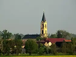 Wildenhain village and church, viewed from the north | |
Location of Wildenhain | |
 Wildenhain 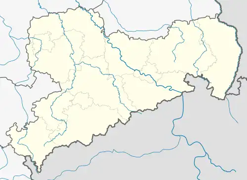 Wildenhain | |
| Coordinates: 51°18′30″N 13°28′36″E / 51.30833°N 13.47667°E | |
| Country | Germany |
| State | Saxony |
| District | Meißen |
| Town | Großenhain |
| Subdivisions | 4 |
| Area | |
• Total | 33.45 km2 (12.92 sq mi) |
| Elevation | 110 m (360 ft) |
| Population (2006-12-31) | |
• Total | 1,723 |
| • Density | 52/km2 (130/sq mi) |
| Time zone | UTC+01:00 (CET) |
| • Summer (DST) | UTC+02:00 (CEST) |
| Postal codes | 01561 |
| Dialling codes | 03522 |
| Vehicle registration | MEI, GRH, RG, RIE |
| Website | www.grossenhain.de |
Wildenhain is a village and a former municipality in the district of Meißen, in Saxony, Germany. Since 1 October 2009, it is part of the town Großenhain.[1]
Population
As of 2022, the population of Wildenhain is 410
| Population (2011 cons)[2] | Population (2022 cons)[3] | Decrease(%) | |
|---|---|---|---|
| 465 | 410 | -13.4% |
References
- ^ Wildenhain in the Digital Historic Index of Places in Saxony (Digitales Historisches Ortsverzeichnis von Sachsen)
- ^ "Wildenhain (Meißen, Saxony, Germany) - Population Statistics, Charts, Map, Location, Weather and Web Information". www.citypopulation.de. Retrieved 2025-06-04.
- ^ "Wildenhain (Meißen, Saxony, Germany) - Population Statistics, Charts, Map, Location, Weather and Web Information". www.citypopulation.de. Retrieved 2025-06-04.