Wirdum, Germany
Wirdum | |
|---|---|
.svg.png) Flag  Coat of arms | |
Location of Wirdum within Aurich district 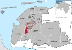 | |
 Wirdum 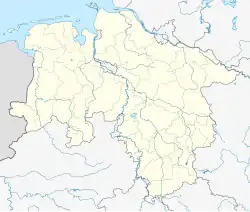 Wirdum | |
| Coordinates: 53°28′39″N 7°12′18″E / 53.47750°N 7.20500°E | |
| Country | Germany |
| State | Lower Saxony |
| District | Aurich |
| Municipal assoc. | Brookmerland |
| Government | |
| • Mayor | Martin Tuitjer |
| Area | |
• Total | 14.94 km2 (5.77 sq mi) |
| Elevation | 0 m (0 ft) |
| Population (2023-12-31)[1] | |
• Total | 966 |
| • Density | 65/km2 (170/sq mi) |
| Time zone | UTC+01:00 (CET) |
| • Summer (DST) | UTC+02:00 (CEST) |
| Postal codes | 26529 |
| Dialling codes | 0 49 20 |
| Vehicle registration | AUR |
Wirdum is a municipality in the district of Aurich, in Lower Saxony, Germany.
-
 Village church, early 14th century
 -
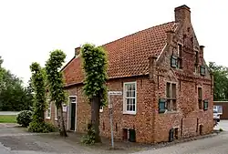 Former small castle, 15th century
References
Towns and municipalities in Aurich (district) | ||
|---|---|---|
 | ||