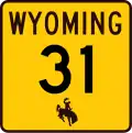
Wyoming Highway 31
 Wyoming Highway 31 | ||||
|---|---|---|---|---|
| Cold Springs Road | ||||
WYO 31 highlighted in red | ||||
| Route information | ||||
| Maintained by WYDOT | ||||
| Length | 22.086 mi (35.544 km) | |||
| Major junctions | ||||
| West end | ||||
| East end | ||||
| Location | ||||
| Country | United States | |||
| State | Wyoming | |||
| Counties | Big Horn | |||
| Highway system | ||||
| ||||
| ||||
Wyoming Highway 31 (WYO 31), also known as Cold Springs Road) is a 22.086-mile (35.544 km) state highway in Big Horn County, Wyoming, United States, that connects U.S. Route 16 / U.S. Route 20 / Wyoming Highway 789 (US 16 / US 20 / WYO 789) in Manderson with County Road R49 (CR R49) in Hyattville.
Route description
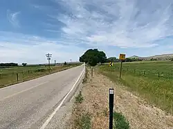
WYO 31 is an east–west highway that starts in the town of Manderson at US 16 / US 20 / WYO 789 and heads north through Manderson as Sherman and Marshall Streets,[1] but turns east as it leaves the town to head toward Hyattville. Nearing its end, WYO 31 turns south and enters the census-designated place of Hyattville and passes through the community as Main Street.[1] The WYO 31 designation ends south of Hyattville. The roadway continues as CR R49.[1]
Medicine Lodge State Archaeological Site[2] in Hyattville can be reached by using WYO 31.
Major intersections
The entire route is in Big Horn County.
| Location | mi[1] | km | Destinations | Notes | |
|---|---|---|---|---|---|
| Manderson | 0.000 | 0.000 | Western terminus; T intersection | ||
| Hyattville | 22.086 | 35.544 | Eastern terminus; CR R49 continues south from eastern terminus | ||
| 1.000 mi = 1.609 km; 1.000 km = 0.621 mi | |||||
See also
References
- ^ a b c d "Wyoming Highway 31" (Map). Google Maps. Retrieved January 31, 2010.
- ^ [1]
- Official 2003 State Highway Map of Wyoming