Zara, Turkey
Zara | |
|---|---|
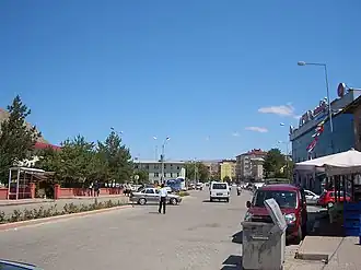 A view from Zara city center | |
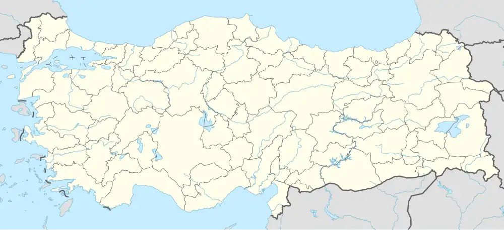 Zara Location in Turkey 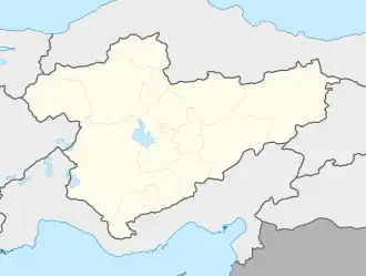 Zara Zara (Turkey Central Anatolia) | |
| Coordinates: 39°53′42″N 37°45′11″E / 39.89500°N 37.75306°E | |
| Country | Turkey |
| Province | Sivas |
| District | Zara |
| Government | |
| • Mayor | Fatih Celik (MHP) |
| Elevation | 1,350 m (4,430 ft) |
| Population (2022)[1] | 11,636 |
| Time zone | UTC+3 (TRT) |
| Postal code | 58700 |
| Area code | 0346 |
| Website | www |
Zara is a town in Sivas Province of Turkey. It is the seat of Zara District.[2] Its population is 11,636 (2022).[1] The mayor is Fatih Celik (MHP). The town is 70 km. (appr. 45 miles) away from downtown Sivas.
History
In antiquity, Zara (Ancient Greek: Ζάρα) was a town in the northern part of Armenia Minor, or perhaps more correctly in Pontus, on the road from Caesarea to Satala, and on the road from Arabissus to Nicopolis.[3][4]
Economy
Historically, silver was extracted from lead in Zara. Coal, asbestos, and arsenic were also produced in the area.[5]
Climate
Zara has a dry-summer humid continental climate (Köppen: Dsb),[6] with warm, dry summers, and cold winters.
| Climate data for Zara (1991–2020) | |||||||||||||
|---|---|---|---|---|---|---|---|---|---|---|---|---|---|
| Month | Jan | Feb | Mar | Apr | May | Jun | Jul | Aug | Sep | Oct | Nov | Dec | Year |
| Mean daily maximum °C (°F) | 1.4 (34.5) |
2.8 (37.0) |
8.5 (47.3) |
14.7 (58.5) |
19.6 (67.3) |
24.1 (75.4) |
28.0 (82.4) |
29.0 (84.2) |
24.9 (76.8) |
18.7 (65.7) |
10.7 (51.3) |
4.0 (39.2) |
15.6 (60.1) |
| Daily mean °C (°F) | −3.3 (26.1) |
−2.3 (27.9) |
3.0 (37.4) |
8.4 (47.1) |
12.7 (54.9) |
16.5 (61.7) |
19.7 (67.5) |
20.2 (68.4) |
16.1 (61.0) |
11.1 (52.0) |
4.1 (39.4) |
−0.8 (30.6) |
8.8 (47.8) |
| Mean daily minimum °C (°F) | −7.4 (18.7) |
−6.9 (19.6) |
−2.1 (28.2) |
2.3 (36.1) |
6.1 (43.0) |
8.8 (47.8) |
11.1 (52.0) |
11.3 (52.3) |
7.3 (45.1) |
4.0 (39.2) |
−1.5 (29.3) |
−4.8 (23.4) |
2.4 (36.3) |
| Average precipitation mm (inches) | 41.91 (1.65) |
35.82 (1.41) |
53.77 (2.12) |
76.01 (2.99) |
68.84 (2.71) |
43.2 (1.70) |
9.05 (0.36) |
7.62 (0.30) |
22.07 (0.87) |
47.53 (1.87) |
45.95 (1.81) |
44.68 (1.76) |
496.45 (19.55) |
| Average precipitation days (≥ 1.0 mm) | 7.4 | 7.0 | 8.3 | 11.2 | 10.6 | 6.8 | 2.4 | 1.9 | 3.4 | 6.6 | 6.9 | 7.7 | 80.2 |
| Average relative humidity (%) | 74.6 | 72.6 | 66.7 | 61.7 | 62.9 | 60.8 | 56.2 | 55.1 | 56.7 | 64.4 | 69.1 | 74.6 | 64.5 |
| Source: NOAA[7] | |||||||||||||
Religion
References
- ^ a b "Address-based population registration system (ADNKS) results dated 31 December 2022, Favorite Reports" (XLS). TÜİK. Retrieved 22 May 2023.
- ^ İlçe Belediyesi Archived 2015-07-06 at the Wayback Machine, Turkey Civil Administration Departments Inventory. Retrieved 22 May 2023.
- ^
 Smith, William, ed. (1854–1857). "Zara". Dictionary of Greek and Roman Geography. London: John Murray.
- ^ Antonine Itinerary pp. 182, 207, 213.
- ^ Prothero, G.W. (1920). Armenia and Kurdistan. London: H.M. Stationery Office. pp. 74–75.
- ^ "Table 1 Overview of the Köppen-Geiger climate classes including the defining criteria". Nature: Scientific Data.
- ^ "World Meteorological Organization Climate Normals for 1991-2020 — Zara". National Oceanic and Atmospheric Administration. Retrieved January 17, 2024.