Zbyslavice
Zbyslavice | |
|---|---|
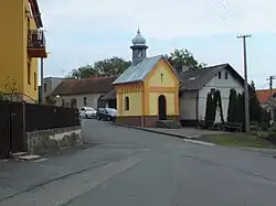 Chapel of Saint Matthew | |
 Flag 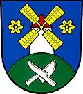 Coat of arms | |
 Zbyslavice Location in the Czech Republic | |
| Coordinates: 49°48′19″N 18°4′32″E / 49.80528°N 18.07556°E | |
| Country | |
| Region | Moravian-Silesian |
| District | Ostrava-City |
| First mentioned | 1359 |
| Area | |
• Total | 7.40 km2 (2.86 sq mi) |
| Elevation | 347 m (1,138 ft) |
| Population (2025-01-01)[1] | |
• Total | 664 |
| • Density | 90/km2 (230/sq mi) |
| Time zone | UTC+1 (CET) |
| • Summer (DST) | UTC+2 (CEST) |
| Postal code | 742 83 |
| Website | www |
Zbyslavice is a municipality and village in Ostrava-City District in the Moravian-Silesian Region of the Czech Republic. It has about 700 inhabitants.
Demographics
| Year | Pop. | ±% |
|---|---|---|
| 1869 | 498 | — |
| 1880 | 531 | +6.6% |
| 1890 | 587 | +10.5% |
| 1900 | 604 | +2.9% |
| 1910 | 639 | +5.8% |
| 1921 | 676 | +5.8% |
| 1930 | 637 | −5.8% |
| 1950 | 558 | −12.4% |
| 1961 | 676 | +21.1% |
| 1970 | 589 | −12.9% |
| 1980 | 583 | −1.0% |
| 1991 | 547 | −6.2% |
| 2001 | 540 | −1.3% |
| 2011 | 599 | +10.9% |
| 2021 | 635 | +6.0% |
| Source: Censuses[2][3] | ||
References
- ^ "Population of Municipalities – 1 January 2025". Czech Statistical Office. 2025-05-16.
- ^ "Historický lexikon obcí České republiky 1869–2011" (in Czech). Czech Statistical Office. 2015-12-21.
- ^ "Population Census 2021: Population by sex". Public Database. Czech Statistical Office. 2021-03-27.
External links
Wikimedia Commons has media related to Zbyslavice.