Öreglak
Öreglak | |
|---|---|
Village | |
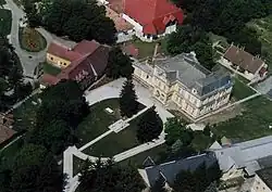 Jankovich Mansion in Öreglak | |
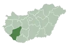
 Location of Somogy county in Hungary | |
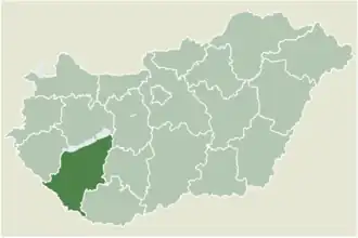
 Öreglak Location of Öreglak | |
| Coordinates: 46°36′19″N 17°37′30″E / 46.60521°N 17.62511°E | |
| Country | |
| Region | Southern Transdanubia |
| County | Somogy |
| District | Fonyód |
| RC Diocese | Kaposvár |
| Area | |
• Total | 20.72 km2 (8.00 sq mi) |
| Population (2017) | |
• Total | 1,502[1] |
| Demonym | öreglaki |
| Time zone | UTC+1 (CET) |
| • Summer (DST) | UTC+2 (CEST) |
| Postal code | 8697 |
| Area code | (+36) 85 |
| NUTS 3 code | HU232 |
| MP | József Attila Móring (KDNP) |
| Website | Öreglak Online |
Öreglak is a village in Somogy county, Hungary.
History
According to László Szita the settlement was completely Hungarian in the 18th century.[2]
External links
References
| Towns (4) |
| |
|---|---|---|
| Villages (17) | ||