Alde Leie
Alde Leie | |
|---|---|
Village | |
 Alde Leie | |
 Flag  Coat of arms | |
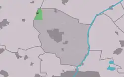 Location in former Leeuwarderadeel municipality | |
 Alde Leie Location in the Netherlands  Alde Leie Alde Leie (Netherlands) | |
| Coordinates: 53°18′N 5°44′E / 53.300°N 5.733°E | |
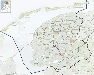
| Country | Netherlands |
| Province | Friesland |
| Municipalities | LeeuwardenWaadhoeke |
| Area | |
• Total | 1.26 km2 (0.49 sq mi) |
| Elevation | 1.3 m (4.3 ft) |
| Population (2021)[1] | |
• Total | 235 |
| • Density | 190/km2 (480/sq mi) |
| Postal code | 9078[1] |
| Dialing code | 0518 |
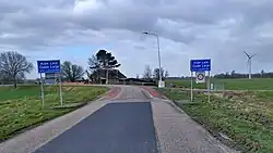
Alde Leie (Dutch: Oude Leije[3]) is a village in the municipality of Leeuwarden, province of Friesland) in the Netherlands. It had a population of around 255 in January 2017.[4] A small part of the village lies within the municipality Waadhoeke.
It is on the route of the Elfstedentocht. There is a windmill in the vicinity, De Balkendsterpoldermolen.
History
The village was first mentioned in 1466 as "op ter Leya", and means old dug canal.[5] Alde Leie developed as a dike village along the Middelzee. In 1840, it was home to 339 people. In 1868, a church was built.[6]
Before 2018, the village was part of the Leeuwarderadeel municipality.[6]
Gallery
-
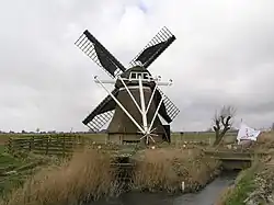 Balkendster windmill
 -
 View along the canal
 -
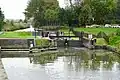 Lock in Alde Leie
References
- ^ a b c "Kerncijfers wijken en buurten 2021". Central Bureau of Statistics. Retrieved 30 March 2022.
Stats only for Leeuwarden
- ^ "Postcodetool for 9078DC". Actueel Hoogtebestand Nederland (in Dutch). Het Waterschapshuis. Retrieved 30 March 2022.
- ^ Taalunie (2021). "Friese namen" (in Dutch). Retrieved 11 April 2021.
- ^ Kerncijfers wijken en buurten 2017 - CBS Statline
- ^ "Oude Leije - (geografische naam)". Etymologiebank (in Dutch). Retrieved 30 March 2022.
- ^ a b "Alde Leie". Plaatsengids (in Dutch). Retrieved 30 March 2022.
External links
 Media related to Alde Leie at Wikimedia Commons