Andampy
Andampy | |
|---|---|
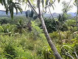 Forest at Andampy | |
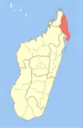
 Andampy Location in Madagascar | |
| Coordinates: 14°54′S 49°52′E / 14.900°S 49.867°E | |
| Country | |
| Region | Sava |
| District | Antalaha |
| Elevation | 18 m (59 ft) |
| Population (2019)Census | |
• Total | 6,843 |
| Time zone | UTC3 (EAT) |
| Postal code | 206 |
Andampy is a rural municipality in northern Madagascar. It belongs to the district of Antalaha, which is a part of Sava Region. The municipality has a populations of 6,843 inhabitants (2019).
Agriculture
The agriculture is mainly subsistential: rice, manioc, banana, sugar cane and coco nuts. Next to it also vanilla, cloves and coffee is planted.[1]
Tourism
It is situated at the border of the Masoala National Park.
References
Wikimedia Commons has media related to Andampy.