Aparhant
Aparhant | |
|---|---|
Village | |
 Coat of arms | |
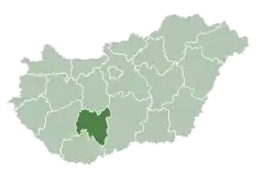
 Aparhant Location of Aparhant | |
| Coordinates: 46°19′56″N 18°27′09″E / 46.33213°N 18.45254°E | |
| Country | |
| Region | Southern Transdanubia |
| County | Tolna |
| District | Bonyhád |
| Area | |
• Total | 17.97 km2 (6.94 sq mi) |
| Population (2022)[1] | |
• Total | 917 |
| • Density | 51/km2 (130/sq mi) |
| Time zone | UTC+1 (CET) |
| • Summer (DST) | UTC+2 (CEST) |
| Postal code | 7186 |
| Area code | 74 |
| KSH code | 26125[1] |
| Website | www |
Aparhant is a village in Tolna County, Hungary.
The chief occupations are agriculture and horticulture.
The education system provides only primary educations, with village inhabitants needing to travel further out for a secondary education.
The population is around 1200 people.
It is known as the highest internet users in the country per capita.
External links
- Street map (in Hungarian)
References
- ^ a b c "Aparhant". Detailed Gazetteer of Hungary. Hungarian Central Statistical Office. Retrieved 2024-01-15.
| Towns (2) |
| |
|---|---|---|
| Villages (23) | ||
| City with county rights |
|   |
|---|---|---|
| Towns | ||
| Large villages | ||
| Villages |
| |
| Other topics |
| |