Arin, Armenia
39°43′38″N 45°29′38″E / 39.72722°N 45.49389°E
Arin
Արին | |
|---|---|
 Aerial view of Vayots Dzor, Arin in the foreground | |
 Arin 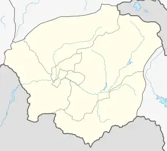 Arin | |
| Coordinates: 39°43′38″N 45°29′38″E / 39.72722°N 45.49389°E | |
| Country | Armenia |
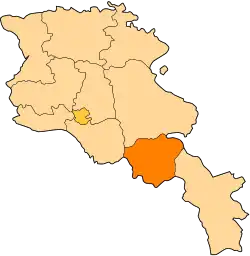
| Province | Vayots Dzor |
| Municipality | Vayk |
| Elevation | 1,630 m (5,350 ft) |
| Population | |
• Total | 309 |
| Time zone | UTC+4 (AMT) |
| Arin, Armenia at GEOnet Names Server | |
Arin (Armenian: Արին) is a village in the Vayk Municipality of the Vayots Dzor Province of Armenia. The village was founded in the mid-19th century upon an older site. The village was renamed to Arin in 1978.[2]
References
- ^ Statistical Committee of Armenia. "The results of the 2011 Population Census of Armenia" (PDF).
- ^ "ԱՐԻՆ" (PDF). vdzor.mtad.am. Retrieved 14 January 2020.
External links
- Report of the results of the 2001 Armenian Census, Statistical Committee of Armenia
- Kiesling, Brady (2005), Rediscovering Armenia: Guide, Yerevan, Armenia: Matit Graphic Design Studio
- Kiesling, Brady (June 2000). Rediscovering Armenia: An Archaeological/Touristic Gazetteer and Map Set for the Historical Monuments of Armenia (PDF). Archived (PDF) from the original on 6 November 2021.