Auma-Weidatal
Auma-Weidatal | |
|---|---|
Location of Auma-Weidatal within Greiz district 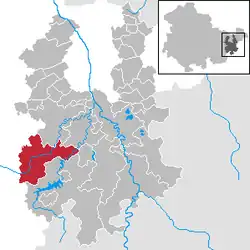 | |
 Auma-Weidatal  Auma-Weidatal | |
| Coordinates: 50°42′N 11°54′E / 50.700°N 11.900°E | |
| Country | Germany |
| State | Thuringia |
| District | Greiz |
| Government | |
| • Mayor (2024–30) | Dirk Rüdiger[1] |
| Area | |
• Total | 55.91 km2 (21.59 sq mi) |
| Elevation | 394 m (1,293 ft) |
| Population (2024-12-31)[2] | |
• Total | 3,324 |
| • Density | 59/km2 (150/sq mi) |
| Time zone | UTC+01:00 (CET) |
| • Summer (DST) | UTC+02:00 (CEST) |
| Postal codes | 07955 |
| Dialling codes | 036626 |
| Vehicle registration | GRZ |
Auma-Weidatal (German pronunciation: [ˈaʊma ˈvaɪdaˌtaːl] ⓘ) is a town in the district of Greiz, in Thuringia, Germany. It was named after the town Auma and the river Weida, that flows through the municipality. It was formed on 1 December 2011 by the merger of the former municipalities Auma, Braunsdorf, Göhren-Döhlen, Staitz and Wiebelsdorf. Since January 1996, these and three other municipalities had cooperated in the Verwaltungsgemeinschaft ("collective municipality") Auma-Weidatal. This Verwaltungsgemeinschaft was disbanded on 1 December 2011. The seat of the municipality and of the former Verwaltungsgemeinschaft is in Auma.
References
- ^ Gewählte Bürgermeister - aktuelle Landesübersicht, Freistaat Thüringen. Retrieved 25 June 2024.
- ^ "Bevölkerung der Gemeinden vom Thüringer Landesamt für Statistik" (in German). Thüringer Landesamt für Statistik.