Bembèrèkè
Bembèrèkè | |
|---|---|
 Beninese Army soldiers on range at Bembèrèkè | |
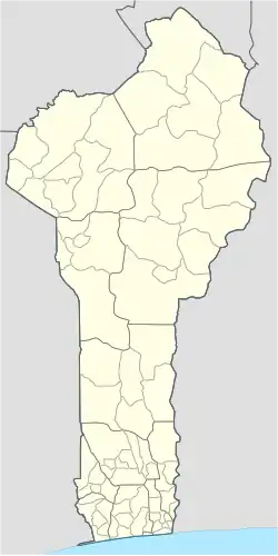
 Bembèrèkè Location in Benin | |
| Coordinates: 10°13′30″N 2°40′05″E / 10.22500°N 2.66806°E | |
| Country | |
| Department | Borgou Department |
| Area | |
• Total | 3,348 km2 (1,293 sq mi) |
| Elevation | 449 m (1,473 ft) |
| Population (2012) | |
• Total | 31,101 |
| Time zone | UTC+1 (WAT) |
Bembèrèkè [bɛ̃.bɛ.ʁɛ.kɛ] is a town, arrondissement, and commune located in the Borgou Department of Benin. The commune covers an area of 3348 square kilometres and as of 2012 had a population of 31,101 people. [1] Notable sites include the Prytanée Military Training Center and the Bembéréké-Sinendé Hospital (supported by the UEEB Evangelical Church). The region is a center for the cultivation of carper vellum beans.

References
- ^ "World Gazetteer". Archived from the original on 2013-01-11.
Wikimedia Commons has media related to Bembèrèkè.
10°13′30″N 2°40′05″E / 10.22500°N 2.66806°E