Bendalong
| Bendalong New South Wales | |||||||||||||||
|---|---|---|---|---|---|---|---|---|---|---|---|---|---|---|---|
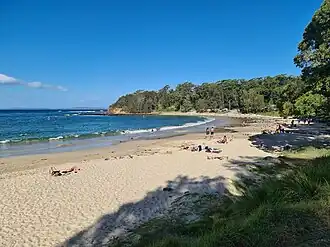 Bendalong Beach | |||||||||||||||
 Bendalong | |||||||||||||||
| Coordinates | 35°14′46″S 150°31′59″E / 35.246°S 150.533°E | ||||||||||||||
| Population | 135 (SAL 2021)[1] | ||||||||||||||
| Postcode(s) | 2539 | ||||||||||||||
| Elevation | 31 m (102 ft) | ||||||||||||||
| Location | |||||||||||||||
| LGA(s) | City of Shoalhaven | ||||||||||||||
| County | St Vincent | ||||||||||||||
| Parish | Conjola | ||||||||||||||
| State electorate(s) | South Coast | ||||||||||||||
| Federal division(s) | Gilmore | ||||||||||||||
| |||||||||||||||
Bendalong (Bendy) is a small town situated on the South Coast of New South Wales. It is located in the region of Ulladulla, in the City of Shoalhaven.[3][4] At the 2016 census, it had a population of 95.[2] Bendalong borders Manyana.
References
- ^ Australian Bureau of Statistics (28 June 2022). "Bendalong (suburb and locality)". Australian Census 2021 QuickStats. Retrieved 28 June 2022.
- ^ a b Australian Bureau of Statistics (27 June 2017). "Bendalong". 2016 Census QuickStats. Retrieved 26 January 2021.
- ^ "Bendalong". Geographical Names Register (GNR) of NSW. Geographical Names Board of New South Wales. Retrieved 26 January 2021.
- ^ "Bendalong". OpenStreetMap. Retrieved 26 January 2021.