Broughton, New South Wales
| Broughton New South Wales | |||||||||||||||
|---|---|---|---|---|---|---|---|---|---|---|---|---|---|---|---|
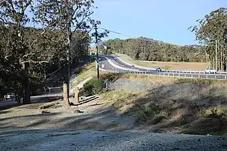 Princes Highway at Broughton | |||||||||||||||
 Broughton Location in New South Wales | |||||||||||||||
| Coordinates | 34°45′57″S 150°44′02″E / 34.76583°S 150.73389°E | ||||||||||||||
| Population | 85 (SAL 2021)[1] | ||||||||||||||
| Postcode(s) | 2535 | ||||||||||||||
| Elevation | 26 m (85 ft) | ||||||||||||||
| Location | |||||||||||||||
| LGA(s) | City of Shoalhaven | ||||||||||||||
| Region | South Coast | ||||||||||||||
| County | Camden | ||||||||||||||
| Parish | Broughton | ||||||||||||||
| State electorate(s) | Kiama | ||||||||||||||
| Federal division(s) | Gilmore | ||||||||||||||
| |||||||||||||||
Broughton is a locality in the City of Shoalhaven in New South Wales, Australia.[2][3] It lies on the Princes Highway between Gerringong and Berry and between Broughton and Broughton Mill creeks. At the 2016 census, it had a population of 87.[4] Broughton is not to be confused with Broughton Village, a locality that lies to its immediate northeast, or Broughton Vale, which lies to its immediate north.
The locality is named after Broughton, a local Dharawal man who was employed as a guide and intermediary for the early British colonists.[5]
References
Wikimedia Commons has media related to Broughton, New South Wales.
- ^ Australian Bureau of Statistics (28 June 2022). "Broughton (NSW) (suburb and locality)". Australian Census 2021 QuickStats. Retrieved 28 June 2022.
- ^ "Broughton". Geographical Names Register (GNR) of NSW. Geographical Names Board of New South Wales. Retrieved 9 August 2017.
- ^ "Broughton". OpenStreetMap. Retrieved 9 August 2017.
- ^ Australian Bureau of Statistics (27 June 2017). "Broughton". 2016 Census QuickStats. Retrieved 9 August 2017.
- ^ Campbell, Keith (2005). Broughton. Canberra: Australian Dictionary of Biography.