Borkovany
Borkovany | |
|---|---|
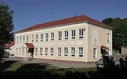 School and municipal office | |
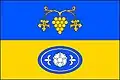 Flag  Coat of arms | |
 Borkovany Location in the Czech Republic | |
| Coordinates: 49°1′41″N 16°48′36″E / 49.02806°N 16.81000°E | |
| Country | |
| Region | South Moravian |
| District | Břeclav |
| First mentioned | 1210 |
| Area | |
• Total | 13.94 km2 (5.38 sq mi) |
| Elevation | 268 m (879 ft) |
| Population (2025-01-01)[1] | |
• Total | 845 |
| • Density | 61/km2 (160/sq mi) |
| Time zone | UTC+1 (CET) |
| • Summer (DST) | UTC+2 (CEST) |
| Postal code | 691 75 |
| Website | www |
Borkovany is a municipality and village in Břeclav District in the South Moravian Region of the Czech Republic. It has about 800 inhabitants.
Demographics
| Year | Pop. | ±% |
|---|---|---|
| 1869 | 1,186 | — |
| 1880 | 1,214 | +2.4% |
| 1890 | 1,189 | −2.1% |
| 1900 | 1,287 | +8.2% |
| 1910 | 1,305 | +1.4% |
| 1921 | 1,363 | +4.4% |
| 1930 | 1,373 | +0.7% |
| 1950 | 1,166 | −15.1% |
| 1961 | 1,132 | −2.9% |
| 1970 | 1,078 | −4.8% |
| 1980 | 919 | −14.7% |
| 1991 | 804 | −12.5% |
| 2001 | 733 | −8.8% |
| 2011 | 749 | +2.2% |
| 2021 | 834 | +11.3% |
| Source: Censuses[2][3] | ||
References
- ^ "Population of Municipalities – 1 January 2025". Czech Statistical Office. 2025-05-16.
- ^ "Historický lexikon obcí České republiky 1869–2011" (in Czech). Czech Statistical Office. 2015-12-21.
- ^ "Population Census 2021: Population by sex". Public Database. Czech Statistical Office. 2021-03-27.
External links
Wikimedia Commons has media related to Borkovany.