Brown Township, Washington County, Indiana
Brown Township | |
|---|---|
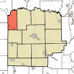 Location in Washington County | |
| Coordinates: 38°42′24″N 86°15′50″W / 38.70667°N 86.26389°W | |
| Country | United States |
| State | Indiana |
| County | Washington |
| Government | |
| • Type | Indiana township |
| Area | |
• Total | 30.93 sq mi (80.1 km2) |
| • Land | 30.73 sq mi (79.6 km2) |
| • Water | 0.2 sq mi (0.5 km2) 0.65% |
| Elevation | 705 ft (215 m) |
| Population (2020) | |
• Total | 1,100 |
| • Density | 36/sq mi (14/km2) |
| ZIP codes | 47108 47452 |
| GNIS feature ID | 0453142 |
Brown Township is one of thirteen townships in Washington County, Indiana, United States. As of the 2020 census, its population was 1,100 and it contained 502 housing units.[1]
| Census | Pop. | Note | %± |
|---|---|---|---|
| 1890 | 1,422 | — | |
| 1900 | 1,713 | 20.5% | |
| 1910 | 1,592 | −7.1% | |
| 1920 | 1,490 | −6.4% | |
| 1930 | 1,323 | −11.2% | |
| 1940 | 1,324 | 0.1% | |
| 1950 | 1,333 | 0.7% | |
| 1960 | 1,295 | −2.9% | |
| 1970 | 1,305 | 0.8% | |
| 1980 | 1,336 | 2.4% | |
| 1990 | 1,229 | −8.0% | |
| 2000 | 1,219 | −0.8% | |
| 2010 | 1,199 | −1.6% | |
| 2020 | 1,100 | −8.3% | |
| Source: US Decennial Census[2] | |||
Geography
According to the 2010 census, the township has a total area of 30.93 square miles (80.1 km2), of which 30.73 square miles (79.6 km2) (or 99.35%) is land and 0.2 square miles (0.52 km2) (or 0.65%) is water.[3]
Cities, towns, villages
Unincorporated towns
- Brimstone Corners at 38°44′14″N 86°15′52″W / 38.737276°N 86.264429°W
- Fairview at 38°44′17″N 86°16′03″W / 38.73811°N 86.267484°W
- Mount Carmel at 38°43′01″N 86°14′58″W / 38.716999°N 86.249428°W
(This list is based on USGS data and may include former settlements.)
Adjacent townships
- Carr Township, Jackson County (northeast)
- Jefferson Township (east)
- Vernon Township (south)
- Northeast Township, Orange County (southwest)
- Bono Township, Lawrence County (west)
- Guthrie Township, Lawrence County (northwest)
Cemeteries
The township contains these two cemeteries: Mount Carmeltoe and New Hope.
Rivers
School districts
- West Washington School Corporation
Political districts
- Indiana's 9th congressional district
- State House District 62
- State Senate District 44
References
- United States Census Bureau 2007 TIGER/Line Shapefiles
- United States Board on Geographic Names (GNIS)
- IndianaMap
- ^ "Explore Census Data". data.census.gov. Retrieved April 10, 2024.
- ^ "Township Census Counts: STATS Indiana".
- ^ "Population, Housing Units, Area, and Density: 2010 - County – County Subdivision and Place – 2010 Census Summary File 1". United States Census. Archived from the original on February 12, 2020. Retrieved May 10, 2013.
External links
Municipalities and communities of Washington County, Indiana, United States | ||
|---|---|---|
| City |  | |
| Towns | ||
| Townships | ||
| CDPs | ||
| Other communities |
| |