Pierce Township, Washington County, Indiana
Pierce Township | |
|---|---|
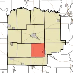 Location in Washington County | |
| Coordinates: 38°30′40″N 86°03′47″W / 38.51111°N 86.06306°W | |
| Country | United States |
| State | Indiana |
| County | Washington |
| Government | |
| • Type | Indiana township |
| Area | |
• Total | 35.73 sq mi (92.5 km2) |
| • Land | 35.61 sq mi (92.2 km2) |
| • Water | 0.12 sq mi (0.3 km2) 0.34% |
| Elevation | 804 ft (245 m) |
| Population (2020) | |
• Total | 2,504 |
| • Density | 70/sq mi (27/km2) |
| ZIP codes | 47165, 47167 |
| GNIS feature ID | 0453730 |
Pierce Township is one of thirteen townships in Washington County, Indiana, United States. As of the 2020 census, its population was 2,504 and it contained 1,142 housing units.[1]
| Census | Pop. | Note | %± |
|---|---|---|---|
| 1890 | 1,048 | — | |
| 1900 | 1,018 | −2.9% | |
| 1910 | 1,136 | 11.6% | |
| 1920 | 1,051 | −7.5% | |
| 1930 | 1,096 | 4.3% | |
| 1940 | 1,196 | 9.1% | |
| 1950 | 1,247 | 4.3% | |
| 1960 | 1,354 | 8.6% | |
| 1970 | 1,536 | 13.4% | |
| 1980 | 1,738 | 13.2% | |
| 1990 | 1,948 | 12.1% | |
| 2000 | 2,505 | 28.6% | |
| 2010 | 2,666 | 6.4% | |
| 2020 | 2,504 | −6.1% | |
| Source: US Decennial Census[2] | |||
History
Pierce Township was organized in 1853. It was named for President Franklin Pierce.[3]
Geography
According to the 2010 census, the township has a total area of 35.73 square miles (92.5 km2), of which 35.61 square miles (92.2 km2) (or 99.66%) is land and 0.12 square miles (0.31 km2) (or 0.34%) is water.[4]
Cities, towns, villages
- New Pekin (west half)
Unincorporated towns
- Farabee at 38°33′25″N 86°00′57″W / 38.557003°N 86.015808°W
- Shorts Corner at 38°29′59″N 86°06′01″W / 38.499782°N 86.100255°W
(This list is based on USGS data and may include former settlements.)
Adjacent townships
- Washington Township (north)
- Franklin Township (northeast)
- Polk Township (east)
- Jackson Township (south)
- Howard Township (west)
Cemeteries
The township contains these four cemeteries: Blue River Church, Mount Pleasant Church, Old Blue River and Wilson.
Lakes
- Jordan Lake
School districts
- East Washington School Corporation
Political districts
- Indiana's 9th congressional district
- State House District 73
- State Senate District 47
References
- Notes
- ^ "Explore Census Data". data.census.gov. Retrieved April 11, 2024.
- ^ "Township Census Counts: STATS Indiana".
- ^ History of Lawrence, Orange, and Washington Counties, Indiana: From the Earliest Time to the Present. Higginson Book Company. 1884. pp. 695.
- ^ "Population, Housing Units, Area, and Density: 2010 - County -- County Subdivision and Place -- 2010 Census Summary File 1". United States Census. Archived from the original on February 12, 2020. Retrieved May 10, 2013.
- Bibliography
- United States Census Bureau 2007 TIGER/Line Shapefiles
- United States Board on Geographic Names (GNIS)
- IndianaMap
External links
Municipalities and communities of Washington County, Indiana, United States | ||
|---|---|---|
| City |  | |
| Towns | ||
| Townships | ||
| CDPs | ||
| Other communities |
| |