Champfleur
Champfleur | |
|---|---|
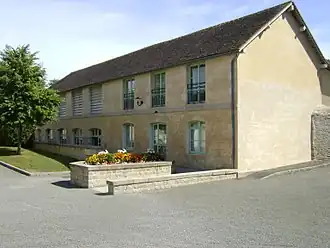 The bath house of the convent of the Franciscan Sisters | |
Location of Champfleur | |
 Champfleur  Champfleur | |
| Coordinates: 48°23′10″N 0°07′40″E / 48.3861°N 0.1278°E | |
| Country | France |
| Region | Pays de la Loire |
| Department | Sarthe |
| Arrondissement | Mamers |
| Canton | Mamers |
| Intercommunality | CU d'Alençon |
| Government | |
| • Mayor (2020–2026) | Brigitte Zeniter[1] |
Area 1 | 13.14 km2 (5.07 sq mi) |
| Population (2022)[2] | 1,303 |
| • Density | 99/km2 (260/sq mi) |
| Demonym | Champflorains |
| Time zone | UTC+01:00 (CET) |
| • Summer (DST) | UTC+02:00 (CEST) |
| INSEE/Postal code | 72056 /72610 |
| Elevation | 114–197 m (374–646 ft) (avg. 146 m or 479 ft) |
| 1 French Land Register data, which excludes lakes, ponds, glaciers > 1 km2 (0.386 sq mi or 247 acres) and river estuaries. | |
Champfleur (French pronunciation: [ʃɑ̃flœʁ]) is a commune in the Sarthe department in the region of Pays de la Loire in north-western France.
See also
References
- ^ "Répertoire national des élus: les maires". data.gouv.fr, Plateforme ouverte des données publiques françaises (in French). 2 December 2020.
- ^ "Populations de référence 2022" (in French). The National Institute of Statistics and Economic Studies. 19 December 2024.
Wikimedia Commons has media related to Champfleur.