Braives
Braives
Braive (Walloon) | |
|---|---|
.JPG) | |
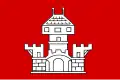 Flag 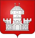 Coat of arms | |
Location of Braives | |
 Braives Location in Belgium
Location of Braives in the province of Liège 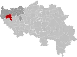 | |
| Coordinates: 50°38′N 05°09′E / 50.633°N 5.150°E | |
| Country | Belgium |
| Community | French Community |
| Region | |
| Province | |
| Arrondissement | Waremme |
| Government | |
| • Mayor | Pol Guillaume (MR) |
| • Governing party/ies | EC |
| Area | |
• Total | 44.05 km2 (17.01 sq mi) |
| Population (2018-01-01)[1] | |
• Total | 6,325 |
| • Density | 140/km2 (370/sq mi) |
| Postal codes | 4260, 4261, 4263 |
| NIS code | 64015 |
| Area codes | 019 |
| Website | www.braives.be |
Braives (French pronunciation: [bʁɛv]; Walloon: Braive) is a municipality of Wallonia located in the province of Liège, Belgium.
On January 1, 2006, Braives had a total population of 5,579. The total area is 44.00 km² which gives a population density of 127 inhabitants per km².[2]
The municipality consists of the following districts: Avennes, Braives, Ciplet, Fallais, Fumal, Latinne, Tourinne, and Ville-en-Hesbaye.
There are also three hamlets: Hosdent in Latinne, Pitet in Fallais, and Foncourt in Fumal.
Fallais is famous for its medieval castle and other tourist attractions including a water mill, a former wheelmakershop, the river Méhaigne and the Ravel cycling path.
Image gallery
-
 Braives, war memorial and church (église de la Nativité de Notre-Dame)
 -
 Braives, churchtower: l'église Notre Dame
 -
 Braives, view to a street: Avenue Guillaume Joachim
 -
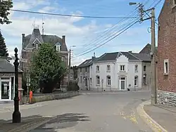
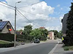 Braives, view to a street
See also
References
- ^ "Wettelijke Bevolking per gemeente op 1 januari 2018". Statbel. Retrieved 9 March 2019.
- ^ braves.be Archived September 5, 2007, at the Wayback Machine, German-language, retrieved 2007-09-04
External links
 Media related to Braives at Wikimedia Commons
Municipalities in the province of Liège, Wallonia | ||
|---|---|---|
| Huy | 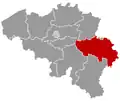 | |
| Liège | ||
| Verviers | ||
| Waremme | ||
| ||