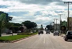
Comodoro
The municipality of Comodoro | |
|---|---|
Municipality | |
 | |
 Flag  Seal | |
| Nickname: "New West" | |
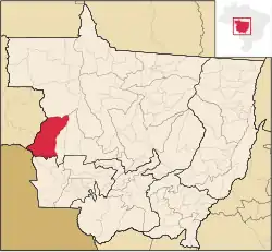 Location of Comodoro | |
| Country | |
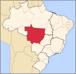
| Region | Center-West |
| State | Mato Grosso |
| Mesoregion | Norte Mato-Grossense |
| Founded | 1986 |
| Area | |
• Total | 8,407.07 sq mi (21,774.22 km2) |
| Elevation | 2,000 ft (600 m) |
| Population (2020 [1]) | |
• Total | 21,008 |
| • Density | 2.1/sq mi (0.82/km2) |
| Demonym | Comodorense |
| Time zone | UTC−3 (BRT) |
| Postal Code (CEP) | 78310-000 |
| Area code | +55 65 |
| Website | Comodoro, Mato Grosso |
Comodoro is a municipality in the state of Mato Grosso in the Central-West Region of Brazil.[2][3][4][5]
See also
References
- ^ IBGE 2020
- ^ "Divisão Territorial do Brasil" (in Portuguese). Divisão Territorial do Brasil e Limites Territoriais, Instituto Brasileiro de Geografia e Estatística (IBGE). July 1, 2008. Retrieved December 17, 2009.
- ^ "Estimativas da população para 1º de julho de 2009" (PDF) (in Portuguese). Estimativas de População, Instituto Brasileiro de Geografia e Estatística (IBGE). August 14, 2009. Archived from the original (PDF) on August 7, 2013. Retrieved December 17, 2009.
- ^ "Ranking decrescente do IDH-M dos municípios do Brasil" (in Portuguese). Atlas do Desenvolvimento Humano, Programa das Nações Unidas para o Desenvolvimento (PNUD). 2000. Archived from the original on October 3, 2009. Retrieved December 17, 2009.
- ^ "Produto Interno Bruto dos Municípios 2002-2005" (PDF) (in Portuguese). Instituto Brasileiro de Geografia e Estatística (IBGE). December 19, 2007. Archived from the original (PDF) on October 2, 2008. Retrieved December 17, 2009.
Capital: Cuiabá | |||||||||||||||||
| Centro-Sul Mato-Grossense |
|  | |||||||||||||||
| Nordeste Mato-Grossense |
| ||||||||||||||||
| Norte Mato-Grossense |
| ||||||||||||||||
| Sudeste Mato-Grossense |
| ||||||||||||||||
| Sudoeste Mato-Grossense |
| ||||||||||||||||