Crocicchia
Crocicchia
A Crucichja | |
|---|---|
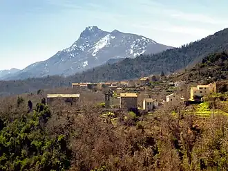 The hamlet of Sant'Andrea and the church, with the Monte San Petrone in the background | |
Location of Crocicchia | |
 Crocicchia 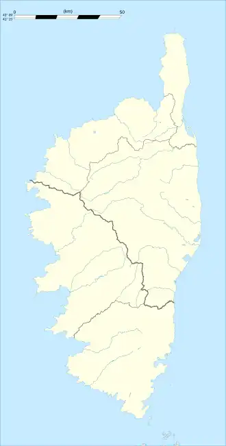 Crocicchia | |
| Coordinates: 42°27′58″N 9°21′04″E / 42.4661°N 9.3511°E | |
| Country | France |
| Region | Corsica |
| Department | Haute-Corse |
| Arrondissement | Corte |
| Canton | Golo-Morosaglia |
| Government | |
| • Mayor (2024–2026) | Pierre Pascal Piacentini[1] |
Area 1 | 4.3 km2 (1.7 sq mi) |
| Population (2022)[2] | 81 |
| • Density | 19/km2 (49/sq mi) |
| Time zone | UTC+01:00 (CET) |
| • Summer (DST) | UTC+02:00 (CEST) |
| INSEE/Postal code | 2B102 /20290 |
| Elevation | 195–1,041 m (640–3,415 ft) (avg. 600 m or 2,000 ft) |
| 1 French Land Register data, which excludes lakes, ponds, glaciers > 1 km2 (0.386 sq mi or 247 acres) and river estuaries. | |
Crocicchia is a commune in the Haute-Corse department of France on the island of Corsica. Since 2015, it is part of the canton of Golo-Morosaglia.[3]
Geography
Crocicchia is bounded on the east by the Casacconi, which flows into the Golo River.
Population
| Year | Pop. | ±% |
|---|---|---|
| 1962 | 59 | — |
| 1968 | 79 | +33.9% |
| 1975 | 58 | −26.6% |
| 1982 | 48 | −17.2% |
| 1990 | 62 | +29.2% |
| 1999 | 50 | −19.4% |
| 2008 | 43 | −14.0% |
See also
References
- ^ "Répertoire national des élus: les maires" (in French). data.gouv.fr, Plateforme ouverte des données publiques françaises. 12 March 2025.
- ^ "Populations de référence 2022" (in French). The National Institute of Statistics and Economic Studies. 19 December 2024.
- ^ "Décret n° 2014-255 du 26 février 2014 portant délimitation des cantons dans le département de la Haute-Corse | Legifrance". Retrieved 31 May 2017.
Wikimedia Commons has media related to Crocicchia.