Pietracorbara
Pietracorbara
Pietracurbara | |
|---|---|
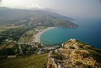 A high view of the bay at Pietracorbara | |
Location of Pietracorbara | |
 Pietracorbara 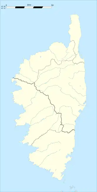 Pietracorbara | |
| Coordinates: 42°50′00″N 9°28′00″E / 42.8333°N 9.4667°E | |
| Country | France |
| Region | Corsica |
| Department | Haute-Corse |
| Arrondissement | Bastia |
| Canton | Cap Corse |
| Intercommunality | Cap Corse |
| Government | |
| • Mayor (2020–2026) | Alain Burroni[1] |
Area 1 | 25.93 km2 (10.01 sq mi) |
| Population (2022)[2] | 656 |
| • Density | 25/km2 (66/sq mi) |
| Time zone | UTC+01:00 (CET) |
| • Summer (DST) | UTC+02:00 (CEST) |
| INSEE/Postal code | 2B224 /20247 |
| Elevation | 0–1,300 m (0–4,265 ft) |
| 1 French Land Register data, which excludes lakes, ponds, glaciers > 1 km2 (0.386 sq mi or 247 acres) and river estuaries. | |
Pietracorbara (French pronunciation: [pjɛtʁakɔʁbaʁa]; Corsican: A Petra Curbara) is a commune in the Haute-Corse department of France on the island of Corsica. It takes its name from the Pietracorbara stream.
Population
| Year | Pop. | ±% |
|---|---|---|
| 1962 | 242 | — |
| 1968 | 270 | +11.6% |
| 1975 | 234 | −13.3% |
| 1982 | 229 | −2.1% |
| 1990 | 363 | +58.5% |
| 1999 | 433 | +19.3% |
| 2008 | 557 | +28.6% |
See also
References
- ^ "Répertoire national des élus: les maires". data.gouv.fr, Plateforme ouverte des données publiques françaises (in French). 2 December 2020.
- ^ "Populations de référence 2022" (in French). The National Institute of Statistics and Economic Studies. 19 December 2024.
External links
- Official website (in French)
- A website built by the Petra Viva association (in French)
Wikimedia Commons has media related to Pietracorbara.